Al Majāridah geodata
Al Majāridah ('Asir) is a populated place; located in Saudi Arabia in Asia/Riyadh (GMT+3) time zone. With population of 14,830 people, there are 62 cities with bigger population in this country. Compared to other cities in Saudi Arabia, 87.6% of cities are located further ↑North; 72.2% of cities are located further →East and 50.5% of cities have lower elevation than Al Majāridah. Note1


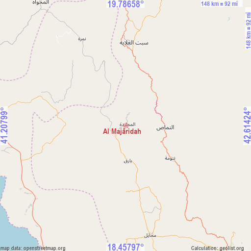
Al Majāridah GPS coordinates[2]
19° 7' 24.996" North, 41° 54' 39.996" East
| Map corner | latitude | longitude |
|---|---|---|
| Upper-left | 19.78658°, | 41.20799° |
| Center: | 19.12361°, | 41.91111° |
| Lower-right: | 18.45797°, | 42.61424° |
| Map W x H: | 147.7×147.7 km | = 91.8×91.8mi |
| max Lat: | 31.67252° ⇑87.6% North |
| Al Majāridah: | 19.12361° |
| min Lat: | ⇓12.4% South 16.57946° |
| min Long | Al Majāridah | max Long |
| 35.69014° | 41.91111° | 54.09599° |
| W 27.8%⇐ | ⇒72.2% E |
Elevation
Elevation of Al Majāridah is 429 m = 1407 ft, and this is 92.4 m = 303 ft below average elevation for this country.
| Max E: |
2385 m = 7825 ft | 49.5% |
| Avg. | 521.4 m = 1711 ft | |
| Al Majāridah | 429 m = 1407 ft | |
Min E: |
3 m = 10 ft | 50.5% |
See also: Saudi Arabia elevation on elevation.city.
Geographical zone
Al Majāridah is located in North Torrid zone (between Equator and Tropic of Cancer). Distance of this Northern Tropic circle is 479.6 km =298 mi to North.| Distance of | km | miles | from Al Majāridah |
|---|---|---|---|
| North Pole | 7880.7 | 4896.8 | to North |
| Arctic Circle | 5274.8 | 3277.6 | to North |
| Tropic Cancer | 479.6 | 298 | to North |
| Equator | 2126.3 | 1321.2 | to South |


Nearby cities:
15 places around Al Majāridah: (largest is in red/bold)
• Abha
118.7 km =73.8 mi,  148°
148°
• Abū ‘Arīsh
258.6 km =160.7 mi,  157°
157°
• Ad Darb
159.9 km =99.4 mi,  166°
166°
• Al Bahah
109.2 km =67.9 mi,  334°
334°
• Al Mindak
132.6 km =82.4 mi, 330°
• An Nimāş
22.1 km =13.7 mi,  83°
83°
• Farasān
270.1 km =167.8 mi,  175°
175°
• Jizan
257.5 km =160 mi, 164°
• Khamis Mushait
126 km =78.3 mi,  136°
136°
• Mislīyah
197.2 km =122.5 mi, 159°
• Mizhirah
269.9 km =167.7 mi, 161°
• Qal‘at Bīshah
121.6 km =75.6 mi,  36°
36°
• Tabālah
105.2 km =65.4 mi,  29°
29°
• Turabah
234.2 km =145.5 mi,  352°
352°
• Şabyā
232.1 km =144.2 mi, 161°
Sources, notices
• [Note1] Compared only with cities in Saudi Arabia existing in our database
• [Src1] Map data: © OpenStreetMap contributors (CC-BY-SA)
• [Src2] Other city data from geonames.org with taken over terms of usage.
• [Src3] Geographical zone / Annual Mean Temperature by Robert A. Rohde @ Wikipedia
