Ad Darb geodata
Ad Darb (Jizan) is a populated place; located in Saudi Arabia in Asia/Riyadh (GMT+3) time zone. With population of 5,378 people, there are 86 cities with bigger population in this country. Compared to other cities in Saudi Arabia, 90.7% of cities are located further ↑North; 69.1% of cities are located further →East and 71.1% of cities have higher elevation than Ad Darb. Note1


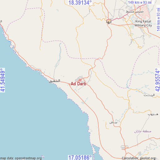
Ad Darb GPS coordinates[2]
17° 43' 22.26" North, 42° 15' 9.396" East
| Map corner | latitude | longitude |
|---|---|---|
| Upper-left | 18.39134°, | 41.54949° |
| Center: | 17.72285°, | 42.25261° |
| Lower-right: | 17.05186°, | 42.95574° |
| Map W x H: | 148.9×148.9 km | = 92.5×92.5mi |
| max Lat: | 31.67252° ⇑90.7% North |
| Ad Darb: | 17.72285° |
| min Lat: | ⇓9.3% South 16.57946° |
| min Long | Ad Darb | max Long |
| 35.69014° | 42.25261° | 54.09599° |
| W 30.9%⇐ | ⇒69.1% E |
Elevation
Elevation of Ad Darb is 73 m = 240 ft, and this is 448.4 m = 1471 ft below average elevation for this country.
| Max E: |
2385 m = 7825 ft | 71.1% |
| Avg. | 521.4 m = 1711 ft | |
| Ad Darb | 73 m = 240 ft | |
Min E: |
3 m = 10 ft | 28.9% |
See also: Saudi Arabia elevation on elevation.city.
Geographical zone
Ad Darb is located in North Torrid zone (between Equator and Tropic of Cancer). Distance of this Northern Tropic circle is 635.3 km =394.8 mi to North.| Distance of | km | miles | from Ad Darb |
|---|---|---|---|
| North Pole | 8036.5 | 4993.6 | to North |
| Arctic Circle | 5430.6 | 3374.4 | to North |
| Tropic Cancer | 635.3 | 394.8 | to North |
| Equator | 1970.6 | 1224.5 | to South |


Nearby cities:
15 places around Ad Darb: (largest is in red/bold)
• Abha
61 km =37.9 mi,  25°
25°
• Abū ‘Arīsh
104 km =64.6 mi,  143°
143°
• Al Jarādīyah
145.2 km =90.2 mi,  151°
151°
• Al Majāridah
159.9 km =99.4 mi,  346°
346°
• An Nimāş
158.8 km =98.7 mi, 354°
• Farasān
114.4 km =71.1 mi,  187°
187°
• Jizan
98 km =60.9 mi,  161°
161°
• Khamis Mushait
81.9 km =50.9 mi,  38°
38°
• Mislīyah
43.6 km =27.1 mi,  132°
132°
• Mizhirah
112 km =69.6 mi, 152°
• Najrān
200.4 km =124.5 mi,  97°
97°
• Qal‘at Bīshah
256 km =159.1 mi,  8°
8°
• Tabālah
248.1 km =154.2 mi,  3°
3°
• Şabyā
75 km =46.6 mi, 148°
• Şāmitah
145.3 km =90.3 mi, 149°
Sources, notices
• [Note1] Compared only with cities in Saudi Arabia existing in our database
• [Src1] Map data: © OpenStreetMap contributors (CC-BY-SA)
• [Src2] Other city data from geonames.org with taken over terms of usage.
• [Src3] Geographical zone / Annual Mean Temperature by Robert A. Rohde @ Wikipedia
