Kadugli geodata
Kadugli (Southern Kordofan) is a seat of a first-order administrative division; located in Sudan in Africa/Khartoum (GMT+2) time zone. With population of 87,666 people, there are 21 cities with bigger population in this country. Compared to other cities in Sudan, 97.2% of cities are located further ↑North; 78.9% of cities are located further →East and 71.8% of cities have lower elevation than Kadugli. Note1


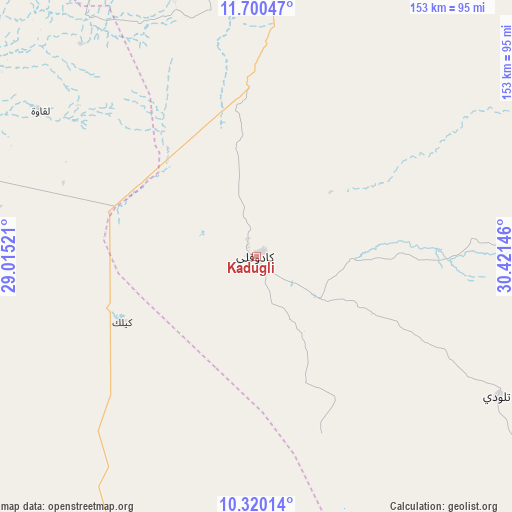
Kadugli GPS coordinates[2]
11° 0' 39.996" North, 29° 43' 5.988" East
| Map corner | latitude | longitude |
|---|---|---|
| Upper-left | 11.70047°, | 29.01521° |
| Center: | 11.01111°, | 29.71833° |
| Lower-right: | 10.32014°, | 30.42146° |
| Map W x H: | 153.5×153.5 km | = 95.4×95.4mi |
| max Lat: | 21.06667° ⇑97.2% North |
| Kadugli: | 11.01111° |
| min Lat: | ⇓2.8% South 10.55° |
| min Long | Kadugli | max Long |
| 22.44725° | 29.71833° | 37.729° |
| W 21.1%⇐ | ⇒78.9% E |
Elevation
Elevation of Kadugli is 506 m = 1660 ft, and this is 56.9 m = 187 ft above average elevation for this country.
| Max E: |
1159 m = 3802 ft | 28.2% |
| Kadugli | 506 m 1660 ft | |
| Avg. | 449.1 m = 1473 ft | |
Min E: |
4 m = 13 ft | 71.8% |
See also: Kadugli elevation on elevation.city.
Geographical zone
Kadugli is located in North Torrid zone (between Equator and Tropic of Cancer). Distance of Equator is 1224.3 km =760.7 mi to South.| Distance of | km | miles | from Kadugli |
|---|---|---|---|
| North Pole | 8782.7 | 5457.3 | to North |
| Arctic Circle | 6176.9 | 3838.1 | to North |
| Tropic Cancer | 1381.6 | 858.5 | to North |
| Equator | 1224.3 | 760.7 | to South |


Nearby cities:
15 places around Kadugli: (largest is in red/bold)
• Abu Jibeha
172 km =106.9 mi,  73°
73°
• Abū Zabad
157.4 km =97.8 mi,  341°
341°
• Al Fūlah
168.6 km =104.8 mi,  298°
298°
• Al Lagowa
77.1 km =47.9 mi, 304°
• Al Mijlad
216.7 km =134.7 mi,  270°
270°
• An Nuhūd
234.1 km =145.5 mi,  323°
323°
• Ar Rahad
215 km =133.6 mi,  28°
28°
• Bārah
307.2 km =190.9 mi,  13°
13°
• Dilling
115.8 km =72 mi,  356°
356°
• El Fula
168.7 km =104.8 mi, 297°
• El Obeid
247.6 km =153.9 mi, 12°
• Marabba
306.9 km =190.7 mi,  60°
60°
• Talodi
83.6 km =51.9 mi,  120°
120°
• Tandaltī
323 km =200.7 mi,  46°
46°
• Umm Ruwaba
266.3 km =165.5 mi,  37°
37°
Sources, notices
• [Note1] Compared only with cities in Sudan existing in our database
• [Src1] Map data: © OpenStreetMap contributors (CC-BY-SA)
• [Src2] Other city data from geonames.org with taken over terms of usage.
• [Src3] Geographical zone / Annual Mean Temperature by Robert A. Rohde @ Wikipedia
