Ad Dabbah geodata
Ad Dabbah (Northern State) is a populated place; located in Sudan in Africa/Khartoum (GMT+2) time zone. With population of 11,626 people, there are 53 cities with bigger population in this country. Compared to other cities in Sudan, 85.9% of cities are located further ↓South; 67.6% of cities are located further →East and 91.5% of cities have higher elevation than Ad Dabbah. Note1


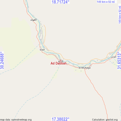
Ad Dabbah GPS coordinates[2]
18° 3' 0" North, 30° 57' 0" East
| Map corner | latitude | longitude |
|---|---|---|
| Upper-left | 18.71724°, | 30.24688° |
| Center: | 18.05°, | 30.95° |
| Lower-right: | 17.38022°, | 31.65313° |
| Map W x H: | 148.7×148.7 km | = 92.4×92.4mi |
| max Lat: | 21.06667° ⇑14.1% North |
| Ad Dabbah: | 18.05° |
| min Lat: | ⇓85.9% South 10.55° |
| min Long | Ad Dabbah | max Long |
| 22.44725° | 30.95° | 37.729° |
| W 32.4%⇐ | ⇒67.6% E |
Elevation
Elevation of Ad Dabbah is 242 m = 794 ft, and this is 207.1 m = 679 ft below average elevation for this country.
| Max E: |
1159 m = 3802 ft | 91.5% |
| Avg. | 449.1 m = 1473 ft | |
| Ad Dabbah | 242 m = 794 ft | |
Min E: |
4 m = 13 ft | 8.5% |
See also: Sudan elevation on elevation.city.
Geographical zone
Ad Dabbah is located in North Torrid zone (between Equator and Tropic of Cancer). Distance of this Northern Tropic circle is 598.9 km =372.1 mi to North.| Distance of | km | miles | from Ad Dabbah |
|---|---|---|---|
| North Pole | 8000.1 | 4971 | to North |
| Arctic Circle | 5394.2 | 3351.8 | to North |
| Tropic Cancer | 598.9 | 372.1 | to North |
| Equator | 2007 | 1247.1 | to South |


Nearby cities:
15 places around Ad Dabbah: (largest is in red/bold)
• Al Qiţena
385 km =239.2 mi,  156°
156°
• Argo
172.5 km =107.2 mi,  341°
341°
• Atbara
323.6 km =201.1 mi,  96°
96°
• Berber
320.7 km =199.3 mi,  90°
90°
• Dongola
135.3 km =84.1 mi, 338°
• Ed Damer
323.8 km =201.2 mi, 98°
• El Bauga
313.4 km =194.7 mi, 85°
• El Matama
295.7 km =183.7 mi,  120°
120°
• Karmah an Nuzul
184.8 km =114.8 mi, 342°
• Khartoum
324.8 km =201.8 mi,  148°
148°
• Kuraymah
110.1 km =68.4 mi,  59°
59°
• Merowe
102.2 km =63.5 mi, 62°
• Omdurman
313 km =194.5 mi, 148°
• Shendi
303.8 km =188.8 mi, 119°
• Wad Rāwah
397.1 km =246.7 mi,  144°
144°
Sources, notices
• [Note1] Compared only with cities in Sudan existing in our database
• [Src1] Map data: © OpenStreetMap contributors (CC-BY-SA)
• [Src2] Other city data from geonames.org with taken over terms of usage.
• [Src3] Geographical zone / Annual Mean Temperature by Robert A. Rohde @ Wikipedia
