Rosso geodata
Rosso (Saint-Louis) is a populated place; located in Senegal in Africa/Dakar (GMT+0) time zone. With population of 9,923 people, there are 41 cities with bigger population in this country. Compared to other cities in Senegal, 96.7% of cities are located further ↓South; 66.7% of cities are located further ←West and 95% of cities have higher elevation than Rosso. Note1


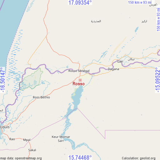
Rosso GPS coordinates[2]
16° 25' 13.008" North, 15° 47' 54.024" West
| Map corner | latitude | longitude |
|---|---|---|
| Upper-left | 17.09354°, | -16.50147° |
| Center: | 16.42028°, | -15.79834° |
| Lower-right: | 15.74468°, | -15.09522° |
| Map W x H: | 150×150 km | = 93.2×93.2mi |
| max Lat: | 16.51293° ⇑3.3% North |
| Rosso: | 16.42028° |
| min Lat: | ⇓96.7% South 12.485° |
| min Long | Rosso | max Long |
| -17.47581° | -15.79834° | -12.18076° |
| W 66.7%⇐ | ⇒33.3% E |
Elevation
Elevation of Rosso is 5 m = 16 ft, and this is 19.5 m = 64 ft below average elevation for this country.
| Max E: |
127 m = 417 ft | 95% |
| Avg. | 24.5 m = 80 ft | |
| Rosso | 5 m = 16 ft | |
Min E: |
0 m = 0 ft | 5% |
See also: Senegal elevation on elevation.city.
Geographical zone
Rosso is located in North Torrid zone (between Equator and Tropic of Cancer). Distance of this Northern Tropic circle is 780.2 km =484.8 mi to North.| Distance of | km | miles | from Rosso |
|---|---|---|---|
| North Pole | 8181.3 | 5083.6 | to North |
| Arctic Circle | 5575.4 | 3464.4 | to North |
| Tropic Cancer | 780.2 | 484.8 | to North |
| Equator | 1825.8 | 1134.5 | to South |


Nearby cities:
15 places around Rosso: (largest is in red/bold)
• Dara
123.9 km =77 mi,  164°
164°
• Diourbel
202.8 km =126 mi,  193°
193°
• Goléré
182 km =113.1 mi,  95°
95°
• Guéoul
119.7 km =74.4 mi,  209°
209°
• Khombole
207.7 km =129.1 mi, 207°
• Louga
100.1 km =62.2 mi, 207°
• Mbaké
181.6 km =112.8 mi,  183°
183°
• Mékhé
170.3 km =105.8 mi, 211°
• Ndibène Dahra
125.6 km =78 mi, 164°
• Ndioum
123.2 km =76.6 mi,  85°
85°
• Richard-Toll
11.4 km =7.1 mi,  65°
65°
• Saint-Louis
86.3 km =53.6 mi,  238°
238°
• Thiès
217.9 km =135.4 mi, 213°
• Tiébo
204.1 km =126.8 mi, 193°
• Touba
174.8 km =108.6 mi, 182°
Sources, notices
• [Note1] Compared only with cities in Senegal existing in our database
• [Src1] Map data: © OpenStreetMap contributors (CC-BY-SA)
• [Src2] Other city data from geonames.org with taken over terms of usage.
• [Src3] Geographical zone / Annual Mean Temperature by Robert A. Rohde @ Wikipedia
