Cadale geodata
Cadale (Middle Shabele) is a populated place; located in Somalia in Africa/Mogadishu (GMT+3) time zone. With population of 5,385 people, there are 44 cities with bigger population in this country. Compared to other cities in Somalia, 75.5% of cities are located further ↑North; 64.2% of cities are located further ←West and 90.6% of cities have higher elevation than Cadale. Note1


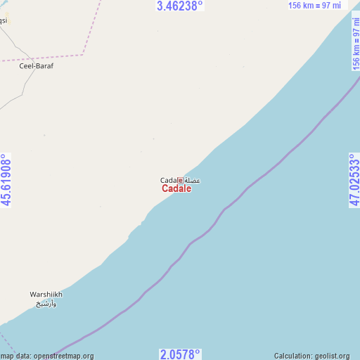
Cadale GPS coordinates[2]
2° 45' 37.08" North, 46° 19' 19.92" East
| Map corner | latitude | longitude |
|---|---|---|
| Upper-left | 3.46238°, | 45.61908° |
| Center: | 2.7603°, | 46.3222° |
| Lower-right: | 2.0578°, | 47.02533° |
| Map W x H: | 156.2×156.2 km | = 97.1×97.1mi |
| max Lat: | 11.96611° ⇑75.5% North |
| Cadale: | 2.7603° |
| min Lat: | ⇓24.5% South -1.21917° |
| min Long | Cadale | max Long |
| 41.83725° | 46.3222° | 51.0773° |
| W 64.2%⇐ | ⇒35.8% E |
Elevation
Elevation of Cadale is 7 m = 23 ft, and this is 282.9 m = 928 ft below average elevation for this country.
| Max E: |
1786 m = 5860 ft | 90.6% |
| Avg. | 289.9 m = 951 ft | |
| Cadale | 7 m = 23 ft | |
Min E: |
-2 m = -7 ft | 9.4% |
See also: Somalia elevation on elevation.city.
Geographical zone
Cadale is located in North Torrid zone (between Equator and Tropic of Cancer). Distance of Equator is 306.9 km =190.7 mi to South.| Distance of | km | miles | from Cadale |
|---|---|---|---|
| North Pole | 9700.1 | 6027.4 | to North |
| Arctic Circle | 7094.3 | 4408.2 | to North |
| Tropic Cancer | 2299 | 1428.5 | to North |
| Equator | 306.9 | 190.7 | to South |


Nearby cities:
15 places around Cadale: (largest is in red/bold)
• Afgooye
150.3 km =93.4 mi,  242°
242°
• Beledweyne
252.3 km =156.8 mi,  330°
330°
• Buulobarde
147.7 km =91.8 mi, 325°
• Buurhakaba
249.3 km =154.9 mi,  271°
271°
• Ceelbuur
216.5 km =134.5 mi,  8°
8°
• Ceeldheer
154 km =95.7 mi,  38°
38°
• Jalalaqsi
105.5 km =65.6 mi,  310°
310°
• Jawhar
91.3 km =56.7 mi, 271°
• Mahaddayweyne
90.6 km =56.3 mi,  285°
285°
• Marka
207.8 km =129.1 mi, 236°
• Mogadishu
135.2 km =84 mi,  233°
233°
• Qoryooley
226.6 km =140.8 mi, 241°
• Tayeeglow
244.9 km =152.2 mi,  304°
304°
• Wanlaweyn
159.4 km =99 mi,  264°
264°
• Xarardheere
270.9 km =168.3 mi, 38°
Sources, notices
• [Note1] Compared only with cities in Somalia existing in our database
• [Src1] Map data: © OpenStreetMap contributors (CC-BY-SA)
• [Src2] Other city data from geonames.org with taken over terms of usage.
• [Src3] Geographical zone / Annual Mean Temperature by Robert A. Rohde @ Wikipedia
