Mboursou Léré geodata
Mboursou Léré (Mayo-Kebbi Ouest) is a populated place; located in Chad in Africa/Ndjamena (GMT+1) time zone. With population of 17,132 people, there are 19 cities with bigger population in this country. Compared to other cities in Chad, 66% of cities are located further ↑North; 100% of cities are located further →East and 97.9% of cities have higher elevation than Mboursou Léré. Note1


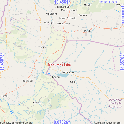
Mboursou Léré GPS coordinates[2]
9° 45' 50.04" North, 14° 9' 14.04" East
| Map corner | latitude | longitude |
|---|---|---|
| Upper-left | 10.4561°, | 13.45078° |
| Center: | 9.7639°, | 14.1539° |
| Lower-right: | 9.07026°, | 14.85703° |
| Map W x H: | 154.1×154.1 km | = 95.8×95.8mi |
| max Lat: | 21.8375° ⇑66% North |
| Mboursou Léré: | 9.7639° |
| min Lat: | ⇓34% South 8.26681° |
| min Long | Mboursou Léré | max Long |
| 14.1539° | 14.1539° | 22.84308° |
| W 0%⇐ | ⇒100% E |
Elevation
Elevation of Mboursou Léré is 287 m = 942 ft, and this is 150.3 m = 493 ft below average elevation for this country.
| Max E: |
1046 m = 3432 ft | 97.9% |
| Avg. | 437.3 m = 1435 ft | |
| Mboursou Léré | 287 m = 942 ft | |
Min E: |
242 m = 794 ft | 2.1% |
See also: Chad elevation on elevation.city.
Geographical zone
Mboursou Léré is located in North Torrid zone (between Equator and Tropic of Cancer). Distance of Equator is 1085.6 km =674.6 mi to South.| Distance of | km | miles | from Mboursou Léré |
|---|---|---|---|
| North Pole | 8921.4 | 5543.5 | to North |
| Arctic Circle | 6315.5 | 3924.3 | to North |
| Tropic Cancer | 1520.3 | 944.7 | to North |
| Equator | 1085.6 | 674.6 | to South |


Nearby cities:
15 places around Mboursou Léré: (largest is in red/bold)
• Benoy
253 km =157.2 mi,  110°
110°
• Beïnamar
181.5 km =112.8 mi,  132°
132°
• Bongor
145.2 km =90.2 mi,  66°
66°
• Bousso
291.1 km =180.9 mi, 74°
• Bébédja
291.1 km =180.9 mi, 114°
• Béré
224.9 km =139.7 mi,  102°
102°
• Dourbali
294.2 km =182.8 mi,  39°
39°
• Gounou Gaya
149.7 km =93 mi, 95°
• Guelendeng
199.4 km =123.9 mi,  49°
49°
• Kelo
188.2 km =116.9 mi, 105°
• Laï
238.9 km =148.4 mi, 99°
• Massenya
286.1 km =177.8 mi, 50°
• Moundou
250.2 km =155.5 mi,  122°
122°
• N'Djamena
278 km =172.7 mi,  20°
20°
• Pala
93.5 km =58.1 mi, 118°
Sources, notices
• [Note1] Compared only with cities in Chad existing in our database
• [Src1] Map data: © OpenStreetMap contributors (CC-BY-SA)
• [Src2] Other city data from geonames.org with taken over terms of usage.
• [Src3] Geographical zone / Annual Mean Temperature by Robert A. Rohde @ Wikipedia
