Bousso geodata
Bousso (Chari-Baguirmi) is a populated place; located in Chad in Africa/Ndjamena (GMT+1) time zone. With population of 13,555 people, there are 26 cities with bigger population in this country. Compared to other cities in Chad, 61.7% of cities are located further ↑North; 55.3% of cities are located further →East and 68.1% of cities have higher elevation than Bousso. Note1


Bousso GPS coordinates[2]
10° 29' 5.028" North, 16° 42' 38.736" East
| Map corner | latitude | longitude |
|---|---|---|
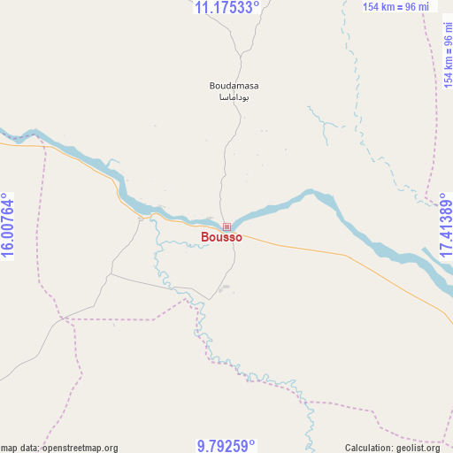
| Upper-left | 11.17533°, | 16.00764° |
| Center: | 10.48473°, | 16.71076° |
| Lower-right: | 9.79259°, | 17.41389° |
| Map W x H: | 153.7×153.7 km | = 95.5×95.5mi |
| max Lat: | 21.8375° ⇑61.7% North |
| Bousso: | 10.48473° |
| min Lat: | ⇓38.3% South 8.26681° |
| min Long | Bousso | max Long |
| 14.1539° | 16.71076° | 22.84308° |
| W 44.7%⇐ | ⇒55.3% E |
Elevation
Elevation of Bousso is 337 m = 1106 ft, and this is 100.3 m = 329 ft below average elevation for this country.
| Max E: |
1046 m = 3432 ft | 68.1% |
| Avg. | 437.3 m = 1435 ft | |
| Bousso | 337 m = 1106 ft | |
Min E: |
242 m = 794 ft | 31.9% |
See also: Chad elevation on elevation.city.
Geographical zone
Bousso is located in North Torrid zone (between Equator and Tropic of Cancer). Distance of Equator is 1165.8 km =724.4 mi to South.| Distance of | km | miles | from Bousso |
|---|---|---|---|
| North Pole | 8841.3 | 5493.7 | to North |
| Arctic Circle | 6235.4 | 3874.5 | to North |
| Tropic Cancer | 1440.1 | 894.8 | to North |
| Equator | 1165.8 | 724.4 | to South |


Nearby cities:
15 places around Bousso: (largest is in red/bold)
• Benoy
172.4 km =107.1 mi,  194°
194°
• Bongor
148.1 km =92 mi,  261°
261°
• Bébédja
201.7 km =125.3 mi,  184°
184°
• Béré
143.1 km =88.9 mi,  205°
205°
• Doba
204.6 km =127.1 mi, 175°
• Dourbali
173.4 km =107.7 mi,  327°
327°
• Goundi
143.9 km =89.4 mi,  150°
150°
• Gounou Gaya
162 km =100.7 mi,  234°
234°
• Guelendeng
135.6 km =84.3 mi,  290°
290°
• Kelo
164 km =101.9 mi,  217°
217°
• Koumra
197.7 km =122.8 mi, 152°
• Laï
129 km =80.2 mi,  200°
200°
• Massenya
118 km =73.3 mi, 330°
• Melfi
148.3 km =92.1 mi,  64°
64°
• Ngama
152.7 km =94.9 mi,  19°
19°
Sources, notices
• [Note1] Compared only with cities in Chad existing in our database
• [Src1] Map data: © OpenStreetMap contributors (CC-BY-SA)
• [Src2] Other city data from geonames.org with taken over terms of usage.
• [Src3] Geographical zone / Annual Mean Temperature by Robert A. Rohde @ Wikipedia
