Bongor geodata
Bongor (Mayo-Kebbi Est) is a seat of a first-order administrative division; located in Chad in Africa/Ndjamena (GMT+1) time zone. With population of 27,770 people, there are 8 cities with bigger population in this country. Compared to other cities in Chad, 63.8% of cities are located further ↑North; 87.2% of cities are located further →East and 72.3% of cities have higher elevation than Bongor. Note1


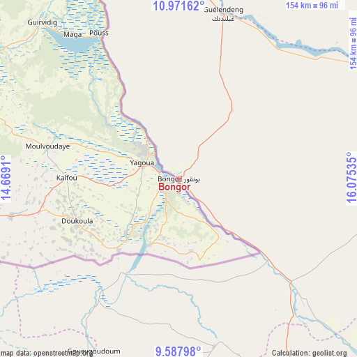
Bongor GPS coordinates[2]
10° 16' 50.016" North, 15° 22' 19.992" East
| Map corner | latitude | longitude |
|---|---|---|
| Upper-left | 10.97162°, | 14.6691° |
| Center: | 10.28056°, | 15.37222° |
| Lower-right: | 9.58798°, | 16.07535° |
| Map W x H: | 153.8×153.8 km | = 95.6×95.6mi |
| max Lat: | 21.8375° ⇑63.8% North |
| Bongor: | 10.28056° |
| min Lat: | ⇓36.2% South 8.26681° |
| min Long | Bongor | max Long |
| 14.1539° | 15.37222° | 22.84308° |
| W 12.8%⇐ | ⇒87.2% E |
Elevation
Elevation of Bongor is 334 m = 1096 ft, and this is 103.3 m = 339 ft below average elevation for this country.
| Max E: |
1046 m = 3432 ft | 72.3% |
| Avg. | 437.3 m = 1435 ft | |
| Bongor | 334 m = 1096 ft | |
Min E: |
242 m = 794 ft | 27.7% |
See also: Chad elevation on elevation.city.
Geographical zone
Bongor is located in North Torrid zone (between Equator and Tropic of Cancer). Distance of Equator is 1143.1 km =710.3 mi to South.| Distance of | km | miles | from Bongor |
|---|---|---|---|
| North Pole | 8864 | 5507.8 | to North |
| Arctic Circle | 6258.1 | 3888.6 | to North |
| Tropic Cancer | 1462.8 | 908.9 | to North |
| Equator | 1143.1 | 710.3 | to South |


Nearby cities:
15 places around Bongor: (largest is in red/bold)
• Benoy
177.8 km =110.5 mi,  144°
144°
• Beïnamar
179.1 km =111.3 mi,  179°
179°
• Bousso
148.1 km =92 mi,  81°
81°
• Bébédja
221.3 km =137.5 mi, 143°
• Béré
137 km =85.1 mi, 141°
• Dourbali
178 km =110.6 mi,  17°
17°
• Gounou Gaya
74 km =46 mi,  167°
167°
• Guelendeng
73.5 km =45.7 mi, 15°
• Kelo
118.1 km =73.4 mi,  156°
156°
• Laï
141.4 km =87.9 mi,  133°
133°
• Massenya
152.3 km =94.6 mi,  34°
34°
• Mboursou Léré
145.2 km =90.2 mi,  246°
246°
• Moundou
205.9 km =127.9 mi, 157°
• N'Djamena
206.2 km =128.1 mi,  350°
350°
• Pala
114 km =70.8 mi,  206°
206°
Sources, notices
• [Note1] Compared only with cities in Chad existing in our database
• [Src1] Map data: © OpenStreetMap contributors (CC-BY-SA)
• [Src2] Other city data from geonames.org with taken over terms of usage.
• [Src3] Geographical zone / Annual Mean Temperature by Robert A. Rohde @ Wikipedia
