Gounou Gaya geodata
Gounou Gaya (Mayo-Kebbi Est) is a populated place; located in Chad in Africa/Ndjamena (GMT+1) time zone. With population of 9,521 people, there are 36 cities with bigger population in this country. Compared to other cities in Chad, 68.1% of cities are located further ↑North; 80.9% of cities are located further →East and 63.8% of cities have higher elevation than Gounou Gaya. Note1


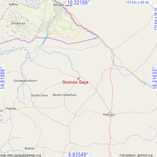
Gounou Gaya GPS coordinates[2]
9° 37' 45.84" North, 15° 30' 47.52" East
| Map corner | latitude | longitude |
|---|---|---|
| Upper-left | 10.32189°, | 14.81008° |
| Center: | 9.6294°, | 15.5132° |
| Lower-right: | 8.93549°, | 16.21633° |
| Map W x H: | 154.2×154.2 km | = 95.8×95.8mi |
| max Lat: | 21.8375° ⇑68.1% North |
| Gounou Gaya: | 9.6294° |
| min Lat: | ⇓31.9% South 8.26681° |
| min Long | Gounou Gaya | max Long |
| 14.1539° | 15.5132° | 22.84308° |
| W 19.1%⇐ | ⇒80.9% E |
Elevation
Elevation of Gounou Gaya is 345 m = 1132 ft, and this is 92.3 m = 303 ft below average elevation for this country.
| Max E: |
1046 m = 3432 ft | 63.8% |
| Avg. | 437.3 m = 1435 ft | |
| Gounou Gaya | 345 m = 1132 ft | |
Min E: |
242 m = 794 ft | 36.2% |
See also: Chad elevation on elevation.city.
Geographical zone
Gounou Gaya is located in North Torrid zone (between Equator and Tropic of Cancer). Distance of Equator is 1070.7 km =665.3 mi to South.| Distance of | km | miles | from Gounou Gaya |
|---|---|---|---|
| North Pole | 8936.4 | 5552.8 | to North |
| Arctic Circle | 6330.5 | 3933.6 | to North |
| Tropic Cancer | 1535.2 | 953.9 | to North |
| Equator | 1070.7 | 665.3 | to South |


Nearby cities:
15 places around Gounou Gaya: (largest is in red/bold)
• Benoy
114 km =70.8 mi,  129°
129°
• Beïnamar
107.7 km =66.9 mi,  187°
187°
• Bongor
74 km =46 mi,  347°
347°
• Bousso
162 km =100.7 mi,  54°
54°
• Bébédja
156.8 km =97.4 mi, 132°
• Béré
78.4 km =48.7 mi,  116°
116°
• Doba
182.7 km =113.5 mi, 126°
• Goundi
205.3 km =127.6 mi,  98°
98°
• Guelendeng
143.3 km =89 mi,  1°
1°
• Kelo
48 km =29.8 mi,  137°
137°
• Laï
90.1 km =56 mi,  106°
106°
• Massenya
210 km =130.5 mi,  20°
20°
• Mboursou Léré
149.7 km =93 mi,  275°
275°
• Moundou
133.7 km =83.1 mi,  152°
152°
• Pala
73 km =45.4 mi,  246°
246°
Sources, notices
• [Note1] Compared only with cities in Chad existing in our database
• [Src1] Map data: © OpenStreetMap contributors (CC-BY-SA)
• [Src2] Other city data from geonames.org with taken over terms of usage.
• [Src3] Geographical zone / Annual Mean Temperature by Robert A. Rohde @ Wikipedia
