Beïnamar geodata
Beïnamar (Logone Occidental) is a populated place; located in Chad in Africa/Ndjamena (GMT+1) time zone. With population of 7,445 people, there are 37 cities with bigger population in this country. Compared to other cities in Chad, 91.5% of cities are located further ↑North; 85.1% of cities are located further →East and 76.6% of cities have lower elevation than Beïnamar. Note1


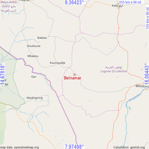
Beïnamar GPS coordinates[2]
8° 40' 11.28" North, 15° 22' 52.68" East
| Map corner | latitude | longitude |
|---|---|---|
| Upper-left | 9.36423°, | 14.67818° |
| Center: | 8.6698°, | 15.3813° |
| Lower-right: | 7.97408°, | 16.08443° |
| Map W x H: | 154.6×154.6 km | = 96.1×96.1mi |
| max Lat: | 21.8375° ⇑91.5% North |
| Beïnamar: | 8.6698° |
| min Lat: | ⇓8.5% South 8.26681° |
| min Long | Beïnamar | max Long |
| 14.1539° | 15.3813° | 22.84308° |
| W 14.9%⇐ | ⇒85.1% E |
Elevation
Elevation of Beïnamar is 450 m = 1476 ft, and this is 12.7 m = 42 ft above average elevation for this country.
| Max E: |
1046 m = 3432 ft | 23.4% |
| Beïnamar | 450 m 1476 ft | |
| Avg. | 437.3 m = 1435 ft | |
Min E: |
242 m = 794 ft | 76.6% |
See also: Chad elevation on elevation.city.
Geographical zone
Beïnamar is located in North Torrid zone (between Equator and Tropic of Cancer). Distance of Equator is 964 km =599 mi to South.| Distance of | km | miles | from Beïnamar |
|---|---|---|---|
| North Pole | 9043.1 | 5619.1 | to North |
| Arctic Circle | 6437.2 | 3999.9 | to North |
| Tropic Cancer | 1641.9 | 1020.2 | to North |
| Equator | 964 | 599 | to South |


Nearby cities:
15 places around Beïnamar: (largest is in red/bold)
• Benoy
108.9 km =67.7 mi,  71°
71°
• Bongor
179.1 km =111.3 mi,  359°
359°
• Bousso
248.9 km =154.7 mi,  35°
35°
• Béboto
177.1 km =110 mi,  104°
104°
• Bébédja
130.2 km =80.9 mi,  89°
89°
• Béré
111.6 km =69.3 mi,  49°
49°
• Doba
161.5 km =100.4 mi, 90°
• Goundi
231.2 km =143.7 mi, 70°
• Gounou Gaya
107.7 km =66.9 mi,  7°
7°
• Kelo
85 km =52.8 mi,  33°
33°
• Koumra
240.3 km =149.3 mi,  83°
83°
• Laï
129.4 km =80.4 mi, 51°
• Mboursou Léré
181.5 km =112.8 mi,  312°
312°
• Moundou
78 km =48.5 mi, 98°
• Pala
93.3 km =58 mi,  325°
325°
Sources, notices
• [Note1] Compared only with cities in Chad existing in our database
• [Src1] Map data: © OpenStreetMap contributors (CC-BY-SA)
• [Src2] Other city data from geonames.org with taken over terms of usage.
• [Src3] Geographical zone / Annual Mean Temperature by Robert A. Rohde @ Wikipedia
