Goundi geodata
Goundi (Mandoul) is a populated place; located in Chad in Africa/Ndjamena (GMT+1) time zone. With population of 10,052 people, there are 35 cities with bigger population in this country. Compared to other cities in Chad, 76.6% of cities are located further ↑North; 57.4% of cities are located further ←West and 53.2% of cities have higher elevation than Goundi. Note1


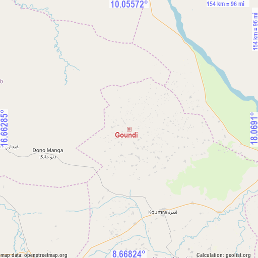
Goundi GPS coordinates[2]
9° 21' 45.612" North, 17° 21' 57.492" East
| Map corner | latitude | longitude |
|---|---|---|
| Upper-left | 10.05572°, | 16.66285° |
| Center: | 9.36267°, | 17.36597° |
| Lower-right: | 8.66824°, | 18.0691° |
| Map W x H: | 154.3×154.3 km | = 95.9×95.9mi |
| max Lat: | 21.8375° ⇑76.6% North |
| Goundi: | 9.36267° |
| min Lat: | ⇓23.4% South 8.26681° |
| min Long | Goundi | max Long |
| 14.1539° | 17.36597° | 22.84308° |
| W 57.4%⇐ | ⇒42.6% E |
Elevation
Elevation of Goundi is 377 m = 1237 ft, and this is 60.3 m = 198 ft below average elevation for this country.
| Max E: |
1046 m = 3432 ft | 53.2% |
| Avg. | 437.3 m = 1435 ft | |
| Goundi | 377 m = 1237 ft | |
Min E: |
242 m = 794 ft | 46.8% |
See also: Chad elevation on elevation.city.
Geographical zone
Goundi is located in North Torrid zone (between Equator and Tropic of Cancer). Distance of Equator is 1041 km =646.8 mi to South.| Distance of | km | miles | from Goundi |
|---|---|---|---|
| North Pole | 8966 | 5571.2 | to North |
| Arctic Circle | 6360.1 | 3952 | to North |
| Tropic Cancer | 1564.9 | 972.4 | to North |
| Equator | 1041 | 646.8 | to South |


Nearby cities:
15 places around Goundi: (largest is in red/bold)
• Benoy
122.3 km =76 mi,  249°
249°
• Bousso
143.9 km =89.4 mi,  330°
330°
• Béboto
130.6 km =81.2 mi,  201°
201°
• Bébédja
116.4 km =72.3 mi,  229°
229°
• Béré
132.9 km =82.6 mi,  267°
267°
• Doba
97.4 km =60.5 mi,  215°
215°
• Gounou Gaya
205.3 km =127.6 mi,  278°
278°
• Kelo
171.2 km =106.4 mi, 267°
• Koumra
54.1 km =33.6 mi,  157°
157°
• Kyabé
173.5 km =107.8 mi,  86°
86°
• Laï
116.9 km =72.6 mi, 271°
• Melfi
198.7 km =123.5 mi,  18°
18°
• Moundou
166.4 km =103.4 mi,  237°
237°
• Moïssala
121.9 km =75.7 mi, 158°
• Sarh
115.3 km =71.6 mi,  102°
102°
Sources, notices
• [Note1] Compared only with cities in Chad existing in our database
• [Src1] Map data: © OpenStreetMap contributors (CC-BY-SA)
• [Src2] Other city data from geonames.org with taken over terms of usage.
• [Src3] Geographical zone / Annual Mean Temperature by Robert A. Rohde @ Wikipedia
