Katoro geodata
Katoro (Kagera) is a populated place; located in Tanzania in Africa/Dar_es_Salaam (GMT+3) time zone. With population of 11,925 people, there are 214 cities with bigger population in this country. Compared to other cities in Tanzania, 98.3% of cities are located further ↓South; 91.6% of cities are located further →East and 57% of cities have lower elevation than Katoro. Note1


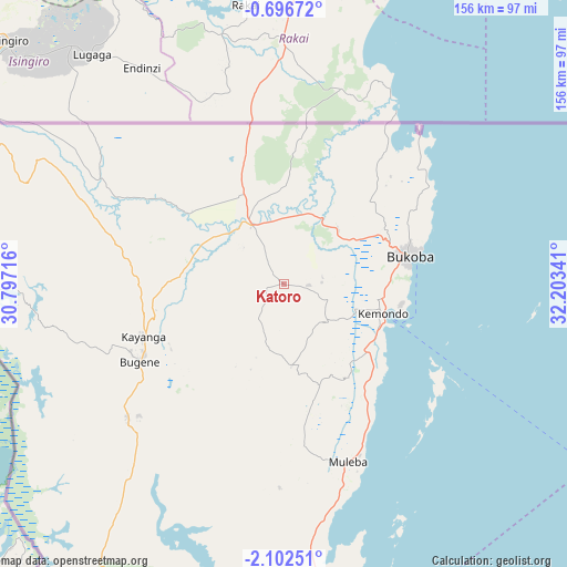
Katoro GPS coordinates[2]
1° 23' 58.992" South, 31° 30' 1.008" East
| Map corner | latitude | longitude |
|---|---|---|
| Upper-left | -0.69672°, | 30.79716° |
| Center: | -1.39972°, | 31.50028° |
| Lower-right: | -2.10251°, | 32.20341° |
| Map W x H: | 156.3×156.3 km | = 97.1×97.1mi |
| max Lat: | -1.14389° ⇑1.7% North |
| Katoro: | -1.39972° |
| min Lat: | ⇓98.3% South -11.36667° |
| min Long | Katoro | max Long |
| 29.62667° | 31.50028° | 40.33333° |
| W 8.4%⇐ | ⇒91.6% E |
Elevation
Elevation of Katoro is 1169 m = 3835 ft, and this is 226.2 m = 742 ft above average elevation for this country.
| Max E: |
2377 m = 7799 ft | 43% |
| Katoro | 1169 m 3835 ft | |
| Avg. | 942.8 m = 3093 ft | |
Min E: |
0 m = 0 ft | 57% |
See also: Tanzania elevation on elevation.city.
Geographical zone
Katoro is located in South Torrid zone (between Equator and Tropic of Capricorn). Distance of Equator is 155.6 km =96.7 mi to North.| Distance of | km | miles | from Katoro |
|---|---|---|---|
| Equator | 155.6 | 96.7 | to North |
| Tropic Capricorn | 2450.3 | 1522.5 | to South |
| Antarctic Circle | 7245.5 | 4502.1 | to South |
| South Pole | 9851.4 | 6121.4 | to South |


Nearby cities:
15 places around Katoro: (largest is in red/bold)
• Biharamulo
138.7 km =86.2 mi,  188°
188°
• Bugene
45.3 km =28.1 mi,  241°
241°
• Bukoba
35.5 km =22.1 mi,  77°
77°
• Bukonyo
170.6 km =106 mi,  111°
111°
• Chato
140.8 km =87.5 mi,  167°
167°
• Kamachumu
27.7 km =17.2 mi,  151°
151°
• Katerero
25.9 km =16.1 mi,  90°
90°
• Kyaka
18.7 km =11.6 mi,  331°
331°
• Muleba
51.8 km =32.2 mi,  160°
160°
• Muriti
170.3 km =105.8 mi, 112°
• Ngara
155.3 km =96.5 mi,  217°
217°
• Nshamba
44.7 km =27.8 mi, 172°
• Nsunga
30.8 km =19.1 mi,  337°
337°
• Nyakahanga
45.9 km =28.5 mi, 240°
• Rulenge
175.4 km =109 mi,  213°
213°
Sources, notices
• [Note1] Compared only with cities in Tanzania existing in our database
• [Src1] Map data: © OpenStreetMap contributors (CC-BY-SA)
• [Src2] Other city data from geonames.org with taken over terms of usage.
• [Src3] Geographical zone / Annual Mean Temperature by Robert A. Rohde @ Wikipedia
