Macheke geodata
Macheke (Mashonaland East) is a populated place; located in Zimbabwe in Africa/Harare (GMT+2) time zone. With population of 3,642 people, there are 47 cities with bigger population in this country. Compared to other cities in Zimbabwe, 58.5% of cities are located further ↓South; 84.6% of cities are located further ←West and 92.3% of cities have lower elevation than Macheke. Note1


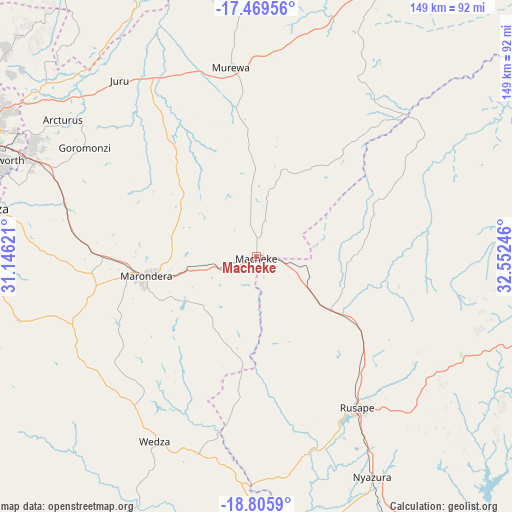
Macheke GPS coordinates[2]
18° 8' 20.436" South, 31° 50' 57.588" East
| Map corner | latitude | longitude |
|---|---|---|
| Upper-left | -17.46956°, | 31.14621° |
| Center: | -18.13901°, | 31.84933° |
| Lower-right: | -18.8059°, | 32.55246° |
| Map W x H: | 148.6×148.6 km | = 92.3×92.3mi |
| max Lat: | -16.03333° ⇑41.5% North |
| Macheke: | -18.13901° |
| min Lat: | ⇓58.5% South -22.21667° |
| min Long | Macheke | max Long |
| 25.83066° | 31.84933° | 32.86667° |
| W 84.6%⇐ | ⇒15.4% E |
Elevation
Elevation of Macheke is 1527 m = 5010 ft, and this is 329.3 m = 1080 ft above average elevation for this country.
| Max E: |
1706 m = 5597 ft | 7.7% |
| Macheke | 1527 m 5010 ft | |
| Avg. | 1197.7 m = 3929 ft | |
Min E: |
402 m = 1319 ft | 92.3% |
See also: Zimbabwe elevation on elevation.city.
Geographical zone
Macheke is located in South Torrid zone (between Equator and Tropic of Capricorn). Distance of this Southern Tropic circle is 589.1 km =366 mi to South.| Distance of | km | miles | from Macheke |
|---|---|---|---|
| Equator | 2016.9 | 1253.2 | to North |
| Tropic Capricorn | 589.1 | 366 | to South |
| Antarctic Circle | 5384.3 | 3345.6 | to South |
| South Pole | 7990.2 | 4964.9 | to South |


Nearby cities:
15 places around Macheke: (largest is in red/bold)
• Beatrice
106.6 km =66.2 mi,  263°
263°
• Bindura
108.1 km =67.2 mi,  329°
329°
• Chitungwiza
83 km =51.6 mi,  279°
279°
• Dorowa Mining Lease
103.7 km =64.4 mi,  185°
185°
• Epworth
79.2 km =49.2 mi,  290°
290°
• Harare
91 km =56.5 mi, 292°
• Headlands
26.3 km =16.3 mi,  125°
125°
• Marondera
31.8 km =19.8 mi, 260°
• Murehwa
55.6 km =34.5 mi,  352°
352°
• Mutoko
91.7 km =57 mi,  25°
25°
• Nyanga
95.5 km =59.3 mi,  95°
95°
• Nyazura
71.4 km =44.4 mi,  151°
151°
• Rusape
52.3 km =32.5 mi, 145°
• Ruwa
69.7 km =43.3 mi, 293°
• Shamva
96.5 km =60 mi,  342°
342°
Sources, notices
• [Note1] Compared only with cities in Zimbabwe existing in our database
• [Src1] Map data: © OpenStreetMap contributors (CC-BY-SA)
• [Src2] Other city data from geonames.org with taken over terms of usage.
• [Src3] Geographical zone / Annual Mean Temperature by Robert A. Rohde @ Wikipedia
