Nyanga geodata
Nyanga (Manicaland) is a populated place; located in Zimbabwe in Africa/Harare (GMT+2) time zone. With population of 4,852 people, there are 43 cities with bigger population in this country. Compared to other cities in Zimbabwe, 53.8% of cities are located further ↓South; 98.5% of cities are located further ←West and 100% of cities have lower elevation than Nyanga. Note1


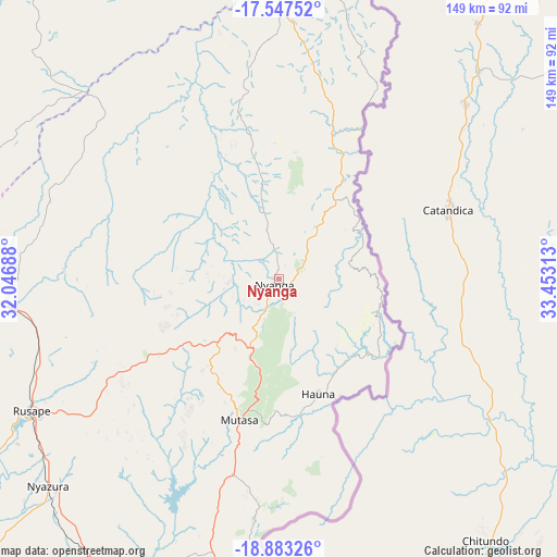
Nyanga GPS coordinates[2]
18° 13' 0.012" South, 32° 45' 0" East
| Map corner | latitude | longitude |
|---|---|---|
| Upper-left | -17.54752°, | 32.04688° |
| Center: | -18.21667°, | 32.75° |
| Lower-right: | -18.88326°, | 33.45313° |
| Map W x H: | 148.5×148.5 km | = 92.3×92.3mi |
| max Lat: | -16.03333° ⇑46.2% North |
| Nyanga: | -18.21667° |
| min Lat: | ⇓53.8% South -22.21667° |
| min Long | Nyanga | max Long |
| 25.83066° | 32.75° | 32.86667° |
| W 98.5%⇐ | ⇒1.5% E |
Elevation
Elevation of Nyanga is 1706 m = 5597 ft, and this is 508.3 m = 1668 ft above average elevation for this country.
| Max E: |
1706 m = 5597 ft | 0% |
| Nyanga | 1706 m 5597 ft | |
| Avg. | 1197.7 m = 3929 ft | |
Min E: |
402 m = 1319 ft | 100% |
See also: Zimbabwe elevation on elevation.city.
Geographical zone
Nyanga is located in South Torrid zone (between Equator and Tropic of Capricorn). Distance of this Southern Tropic circle is 580.4 km =360.6 mi to South.| Distance of | km | miles | from Nyanga |
|---|---|---|---|
| Equator | 2025.5 | 1258.6 | to North |
| Tropic Capricorn | 580.4 | 360.6 | to South |
| Antarctic Circle | 5375.7 | 3340.3 | to South |
| South Pole | 7981.6 | 4959.5 | to South |


Nearby cities:
15 places around Nyanga: (largest is in red/bold)
• Chimanimani
176.5 km =109.7 mi,  176°
176°
• Dorowa Mining Lease
141.5 km =87.9 mi,  228°
228°
• Epworth
173.3 km =107.7 mi,  282°
282°
• Headlands
74.1 km =46 mi,  264°
264°
• Macheke
95.5 km =59.3 mi, 275°
• Marondera
126.6 km =78.7 mi,  271°
271°
• Murehwa
120.5 km =74.9 mi,  301°
301°
• Mutare
84.3 km =52.4 mi,  185°
185°
• Mutoko
106.7 km =66.3 mi,  328°
328°
• Nyazura
82 km =51 mi, 228°
• Odzi
90.4 km =56.2 mi,  203°
203°
• Penhalonga
75.2 km =46.7 mi, 184°
• Rusape
74.2 km =46.1 mi,  242°
242°
• Ruwa
163.2 km =101.4 mi, 282°
• Shamva
160 km =99.4 mi,  308°
308°
Sources, notices
• [Note1] Compared only with cities in Zimbabwe existing in our database
• [Src1] Map data: © OpenStreetMap contributors (CC-BY-SA)
• [Src2] Other city data from geonames.org with taken over terms of usage.
• [Src3] Geographical zone / Annual Mean Temperature by Robert A. Rohde @ Wikipedia
