Headlands geodata
Headlands (Manicaland) is a populated place; located in Zimbabwe in Africa/Harare (GMT+2) time zone. With population of 1,728 people, there are 59 cities with bigger population in this country. Compared to other cities in Zimbabwe, 50.8% of cities are located further ↓South; 86.2% of cities are located further ←West and 95.4% of cities have lower elevation than Headlands. Note1


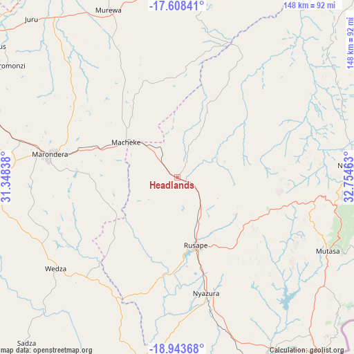
Headlands GPS coordinates[2]
18° 16' 38.388" South, 32° 3' 5.4" East
| Map corner | latitude | longitude |
|---|---|---|
| Upper-left | -17.60841°, | 31.34838° |
| Center: | -18.27733°, | 32.0515° |
| Lower-right: | -18.94368°, | 32.75463° |
| Map W x H: | 148.5×148.5 km | = 92.3×92.3mi |
| max Lat: | -16.03333° ⇑49.2% North |
| Headlands: | -18.27733° |
| min Lat: | ⇓50.8% South -22.21667° |
| min Long | Headlands | max Long |
| 25.83066° | 32.0515° | 32.86667° |
| W 86.2%⇐ | ⇒13.8% E |
Elevation
Elevation of Headlands is 1563 m = 5128 ft, and this is 365.3 m = 1198 ft above average elevation for this country.
| Max E: |
1706 m = 5597 ft | 4.6% |
| Headlands | 1563 m 5128 ft | |
| Avg. | 1197.7 m = 3929 ft | |
Min E: |
402 m = 1319 ft | 95.4% |
See also: Zimbabwe elevation on elevation.city.
Geographical zone
Headlands is located in South Torrid zone (between Equator and Tropic of Capricorn). Distance of this Southern Tropic circle is 573.7 km =356.5 mi to South.| Distance of | km | miles | from Headlands |
|---|---|---|---|
| Equator | 2032.2 | 1262.8 | to North |
| Tropic Capricorn | 573.7 | 356.5 | to South |
| Antarctic Circle | 5368.9 | 3336.1 | to South |
| South Pole | 7974.8 | 4955.3 | to South |


Nearby cities:
15 places around Headlands: (largest is in red/bold)
• Chitungwiza
107.2 km =66.6 mi,  285°
285°
• Dorowa Mining Lease
93.3 km =58 mi,  199°
199°
• Epworth
104.8 km =65.1 mi, 294°
• Harare
116.8 km =72.6 mi,  295°
295°
• Macheke
26.3 km =16.3 mi,  305°
305°
• Marondera
53.7 km =33.4 mi,  280°
280°
• Murehwa
76 km =47.2 mi,  338°
338°
• Mutare
101 km =62.8 mi,  139°
139°
• Mutoko
99.6 km =61.9 mi,  10°
10°
• Nyanga
74.1 km =46 mi,  84°
84°
• Nyazura
49.2 km =30.6 mi,  165°
165°
• Odzi
84.7 km =52.6 mi,  153°
153°
• Penhalonga
96.4 km =59.9 mi, 135°
• Rusape
29 km =18 mi,  163°
163°
• Ruwa
95.5 km =59.3 mi, 296°
Sources, notices
• [Note1] Compared only with cities in Zimbabwe existing in our database
• [Src1] Map data: © OpenStreetMap contributors (CC-BY-SA)
• [Src2] Other city data from geonames.org with taken over terms of usage.
• [Src3] Geographical zone / Annual Mean Temperature by Robert A. Rohde @ Wikipedia
