Fayrōz Kōh geodata
Fayrōz Kōh (Ghowr) is a seat of a first-order administrative division; located in Afghanistan in Asia/Kabul (GMT+4.5) time zone. With population of 15,000 people, there are 48 cities with bigger population in this country. Compared to other cities in Afghanistan, 54.3% of cities are located further ↑North; 78.1% of cities are located further →East and 85.9% of cities have lower elevation than Fayrōz Kōh. Note1


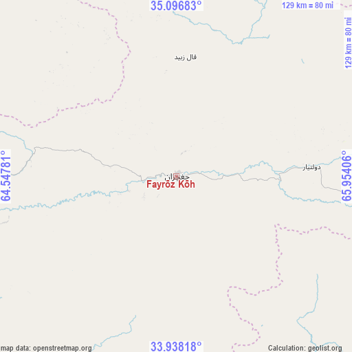
Fayrōz Kōh GPS coordinates[2]
34° 31' 10.272" North, 65° 15' 3.348" East
| Map corner | latitude | longitude |
|---|---|---|
| Upper-left | 35.09683°, | 64.54781° |
| Center: | 34.51952°, | 65.25093° |
| Lower-right: | 33.93818°, | 65.95406° |
| Map W x H: | 128.8×128.8 km | = 80×80mi |
| max Lat: | 38.4435° ⇑54.3% North |
| Fayrōz Kōh: | 34.51952° |
| min Lat: | ⇓45.7% South 30.15° |
| min Long | Fayrōz Kōh | max Long |
| 61.06667° | 65.25093° | 72.318° |
| W 21.9%⇐ | ⇒78.1% E |
Elevation
Elevation of Fayrōz Kōh is 2263 m = 7425 ft, and this is 844.6 m = 2771 ft above average elevation for this country.
| Max E: |
3068 m = 10066 ft | 14.1% |
| Fayrōz Kōh | 2263 m 7425 ft | |
| Avg. | 1418.4 m = 4654 ft | |
Min E: |
254 m = 833 ft | 85.9% |
See also: Afghanistan elevation on elevation.city.
Geographical zone
Fayrōz Kōh is located in North temperate zone (between Tropic of Cancer and the Arctic Circle). Distance of this Northern Tropic circle is 1232.3 km =765.7 mi to South.| Distance of | km | miles | from Fayrōz Kōh |
|---|---|---|---|
| North Pole | 6168.9 | 3833.2 | to North |
| Arctic Circle | 3563 | 2213.9 | to North |
| Tropic Cancer | 1232.3 | 765.7 | to South |
| Equator | 3838.2 | 2384.9 | to South |


Nearby cities:
15 places around Fayrōz Kōh: (largest is in red/bold)
• Chīras
120 km =74.6 mi,  33°
33°
• Dowlatyār
49.8 km =30.9 mi,  85°
85°
• Dū Laīnah
58.8 km =36.5 mi,  226°
226°
• Jawand
117.4 km =72.9 mi,  301°
301°
• Khadīr
91.4 km =56.8 mi,  136°
136°
• La‘l
94.3 km =58.6 mi, 91°
• Lāsh
104.9 km =65.2 mi,  335°
335°
• Nīlī
120.1 km =74.6 mi, 137°
• Pasāband
99.3 km =61.7 mi,  201°
201°
• Qal‘ah-ye Shahr
117.9 km =73.3 mi,  14°
14°
• Quchanghī
107.2 km =66.6 mi,  118°
118°
• Sar Chakān
131.5 km =81.7 mi,  359°
359°
• Sar-e Tayghān
118.9 km =73.9 mi,  160°
160°
• Shahrak
98.2 km =61 mi,  242°
242°
• Taywarah
134.8 km =83.8 mi,  214°
214°
Sources, notices
• [Note1] Compared only with cities in Afghanistan existing in our database
• [Src1] Map data: © OpenStreetMap contributors (CC-BY-SA)
• [Src2] Other city data from geonames.org with taken over terms of usage.
• [Src3] Geographical zone / Annual Mean Temperature by Robert A. Rohde @ Wikipedia
