Taywarah geodata
Taywarah (Ghowr) is a seat of a second-order administrative division; located in Afghanistan in Asia/Kabul (GMT+4.5) time zone. In our database, there are 93 cities with bigger population. Compared to other cities in Afghanistan, 74.3% of cities are located further ↑North; 84.6% of cities are located further →East and 82.6% of cities have lower elevation than Taywarah. Note1


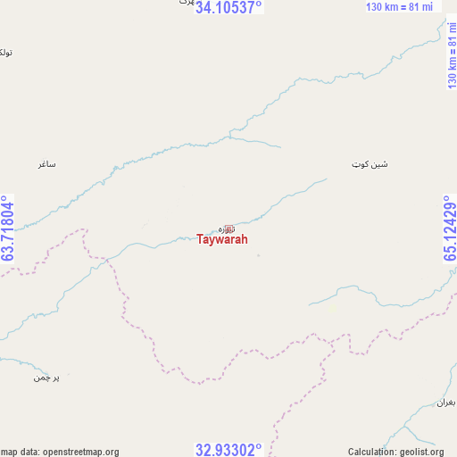
Taywarah GPS coordinates[2]
33° 31' 16.248" North, 64° 25' 16.176" East
| Map corner | latitude | longitude |
|---|---|---|
| Upper-left | 34.10537°, | 63.71804° |
| Center: | 33.52118°, | 64.42116° |
| Lower-right: | 32.93302°, | 65.12429° |
| Map W x H: | 130.4×130.4 km | = 81×81mi |
| max Lat: | 38.4435° ⇑74.3% North |
| Taywarah: | 33.52118° |
| min Lat: | ⇓25.7% South 30.15° |
| min Long | Taywarah | max Long |
| 61.06667° | 64.42116° | 72.318° |
| W 15.4%⇐ | ⇒84.6% E |
Elevation
Elevation of Taywarah is 2160 m = 7087 ft, and this is 741.6 m = 2433 ft above average elevation for this country.
| Max E: |
3068 m = 10066 ft | 17.4% |
| Taywarah | 2160 m 7087 ft | |
| Avg. | 1418.4 m = 4654 ft | |
Min E: |
254 m = 833 ft | 82.6% |
See also: Afghanistan elevation on elevation.city.
Geographical zone
Taywarah is located in North temperate zone (between Tropic of Cancer and the Arctic Circle). Distance of this Northern Tropic circle is 1121.3 km =696.7 mi to South.| Distance of | km | miles | from Taywarah |
|---|---|---|---|
| North Pole | 6279.9 | 3902.1 | to North |
| Arctic Circle | 3674 | 2282.9 | to North |
| Tropic Cancer | 1121.3 | 696.7 | to South |
| Equator | 3727.2 | 2316 | to South |


Nearby cities:
15 places around Taywarah: (largest is in red/bold)
• Chisht-e Sharīf
111.3 km =69.2 mi,  325°
325°
• Dasht-e Qal‘ah
76.9 km =47.8 mi,  224°
224°
• Dū Laīnah
78.2 km =48.6 mi,  25°
25°
• Fayrōz Kōh
134.8 km =83.8 mi, 34°
• Kajrān
103.9 km =64.6 mi,  109°
109°
• Khadīr
146.8 km =91.2 mi,  72°
72°
• Mūsá Qal‘ah
123.3 km =76.6 mi,  165°
165°
• Now Zād
124.4 km =77.3 mi,  177°
177°
• Pasāband
44.2 km =27.5 mi,  64°
64°
• Qal‘ah-ye Fārsī
112.5 km =69.9 mi,  285°
285°
• Qal‘ah-ye Kuhnah
122.8 km =76.3 mi,  214°
214°
• Sar-e Tayghān
116.4 km =72.3 mi,  90°
90°
• Shahrak
66.1 km =41.1 mi,  350°
350°
• Tītān
55 km =34.2 mi, 290°
• Tūlak
81.5 km =50.6 mi,  308°
308°
Sources, notices
• [Note1] Compared only with cities in Afghanistan existing in our database
• [Src1] Map data: © OpenStreetMap contributors (CC-BY-SA)
• [Src2] Other city data from geonames.org with taken over terms of usage.
• [Src3] Geographical zone / Annual Mean Temperature by Robert A. Rohde @ Wikipedia
