Now Zād geodata
Now Zād (Helmand) is a seat of a second-order administrative division; located in Afghanistan in Asia/Kabul (GMT+4.5) time zone. In our database, there are 93 cities with bigger population. Compared to other cities in Afghanistan, 89.4% of cities are located further ↑North; 84.2% of cities are located further →East and 56.3% of cities have higher elevation than Now Zād. Note1


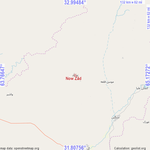
Now Zād GPS coordinates[2]
32° 24' 11.34" North, 64° 28' 10.524" East
| Map corner | latitude | longitude |
|---|---|---|
| Upper-left | 32.99484°, | 63.76647° |
| Center: | 32.40315°, | 64.46959° |
| Lower-right: | 31.80756°, | 65.17272° |
| Map W x H: | 132×132 km | = 82×82mi |
| max Lat: | 38.4435° ⇑89.4% North |
| Now Zād: | 32.40315° |
| min Lat: | ⇓10.6% South 30.15° |
| min Long | Now Zād | max Long |
| 61.06667° | 64.46959° | 72.318° |
| W 15.8%⇐ | ⇒84.2% E |
Elevation
Elevation of Now Zād is 1220 m = 4003 ft, and this is 198.4 m = 651 ft below average elevation for this country.
| Max E: |
3068 m = 10066 ft | 56.3% |
| Avg. | 1418.4 m = 4654 ft | |
| Now Zād | 1220 m = 4003 ft | |
Min E: |
254 m = 833 ft | 43.7% |
See also: Afghanistan elevation on elevation.city.
Geographical zone
Now Zād is located in North temperate zone (between Tropic of Cancer and the Arctic Circle). Distance of this Northern Tropic circle is 997 km =619.5 mi to South.| Distance of | km | miles | from Now Zād |
|---|---|---|---|
| North Pole | 6404.2 | 3979.4 | to North |
| Arctic Circle | 3798.3 | 2360.2 | to North |
| Tropic Cancer | 997 | 619.5 | to South |
| Equator | 3602.9 | 2238.7 | to South |


Nearby cities:
15 places around Now Zād: (largest is in red/bold)
• Chinār
73.8 km =45.9 mi,  125°
125°
• Dasht-e Qal‘ah
91.3 km =56.7 mi,  319°
319°
• Dê Nārkhēl Kêlay
109.4 km =68 mi,  88°
88°
• Gereshk
65.4 km =40.6 mi,  171°
171°
• Kajrān
129.3 km =80.3 mi,  46°
46°
• Kishk-e Nakhūd
102.6 km =63.8 mi,  147°
147°
• Lashkar Gāh
90.5 km =56.2 mi,  185°
185°
• Mūsá Qal‘ah
26.3 km =16.3 mi,  79°
79°
• Pāshmūl
130.9 km =81.3 mi,  135°
135°
• Qal‘ah-ye Kuhnah
78.9 km =49 mi,  287°
287°
• Sangīn
50.4 km =31.3 mi, 136°
• Taywarah
124.4 km =77.3 mi,  357°
357°
• Wāshēr
60.1 km =37.3 mi,  253°
253°
• Zīārat-e Shāh Maqşūd
105.3 km =65.4 mi,  116°
116°
• Ḩukūmat-e Nād ‘Alī
87.3 km =54.2 mi, 194°
Sources, notices
• [Note1] Compared only with cities in Afghanistan existing in our database
• [Src1] Map data: © OpenStreetMap contributors (CC-BY-SA)
• [Src2] Other city data from geonames.org with taken over terms of usage.
• [Src3] Geographical zone / Annual Mean Temperature by Robert A. Rohde @ Wikipedia
