Dasht-e Qal‘ah geodata
Dasht-e Qal‘ah (Farah) is a seat of a second-order administrative division; located in Afghanistan in Asia/Kabul (GMT+4.5) time zone. In our database, there are 93 cities with bigger population. Compared to other cities in Afghanistan, 81.7% of cities are located further ↑North; 87.5% of cities are located further →East and 63% of cities have lower elevation than Dasht-e Qal‘ah. Note1


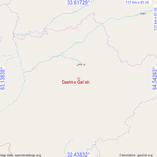
Dasht-e Qal‘ah GPS coordinates[2]
33° 1' 47.208" North, 63° 50' 22.2" East
| Map corner | latitude | longitude |
|---|---|---|
| Upper-left | 33.61729°, | 63.13638° |
| Center: | 33.02978°, | 63.8395° |
| Lower-right: | 32.43832°, | 64.54263° |
| Map W x H: | 131.1×131.1 km | = 81.5×81.5mi |
| max Lat: | 38.4435° ⇑81.7% North |
| Dasht-e Qal‘ah: | 33.02978° |
| min Lat: | ⇓18.3% South 30.15° |
| min Long | Dasht-e Qal‘a | max Long |
| 61.06667° | 63.8395° | 72.318° |
| W 12.5%⇐ | ⇒87.5% E |
Elevation
Elevation of Dasht-e Qal‘ah is 1718 m = 5636 ft, and this is 299.6 m = 983 ft above average elevation for this country.
| Max E: |
3068 m = 10066 ft | 37% |
| Dasht-e Qal‘ah | 1718 m 5636 ft | |
| Avg. | 1418.4 m = 4654 ft | |
Min E: |
254 m = 833 ft | 63% |
See also: Afghanistan elevation on elevation.city.
Geographical zone
Dasht-e Qal‘ah is located in North temperate zone (between Tropic of Cancer and the Arctic Circle). Distance of this Northern Tropic circle is 1066.6 km =662.8 mi to South.| Distance of | km | miles | from Dasht-e Qal‘ah |
|---|---|---|---|
| North Pole | 6334.5 | 3936.1 | to North |
| Arctic Circle | 3728.6 | 2316.8 | to North |
| Tropic Cancer | 1066.6 | 662.8 | to South |
| Equator | 3672.6 | 2282 | to South |


Nearby cities:
15 places around Dasht-e Qal‘ah: (largest is in red/bold)
• Chisht-e Sharīf
146.8 km =91.2 mi,  356°
356°
• Dū Laīnah
152.8 km =94.9 mi,  34°
34°
• Gereshk
150.9 km =93.8 mi,  152°
152°
• Markaz-e Ḩukūmat-e Sulţān-e Bakwāh
121 km =75.2 mi,  223°
223°
• Mūsá Qal‘ah
106.7 km =66.3 mi,  127°
127°
• Now Zād
91.3 km =56.7 mi,  139°
139°
• Pasāband
119.3 km =74.1 mi,  52°
52°
• Qal‘ah-ye Fārsī
100.4 km =62.4 mi,  326°
326°
• Qal‘ah-ye Kuhnah
48.8 km =30.3 mi,  199°
199°
• Sangīn
141.6 km =88 mi, 138°
• Shahrak
127.3 km =79.1 mi,  19°
19°
• Taywarah
76.9 km =47.8 mi,  44°
44°
• Tītān
73.5 km =45.7 mi,  1°
1°
• Tūlak
105.6 km =65.6 mi,  354°
354°
• Wāshēr
86.6 km =53.8 mi,  179°
179°
Sources, notices
• [Note1] Compared only with cities in Afghanistan existing in our database
• [Src1] Map data: © OpenStreetMap contributors (CC-BY-SA)
• [Src2] Other city data from geonames.org with taken over terms of usage.
• [Src3] Geographical zone / Annual Mean Temperature by Robert A. Rohde @ Wikipedia
