Pasāband geodata
Pasāband (Ghowr) is a seat of a second-order administrative division; located in Afghanistan in Asia/Kabul (GMT+4.5) time zone. In our database, there are 93 cities with bigger population. Compared to other cities in Afghanistan, 71.1% of cities are located further ↑North; 81.7% of cities are located further →East and 93.2% of cities have lower elevation than Pasāband. Note1


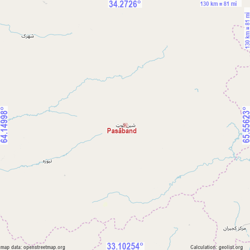
Pasāband GPS coordinates[2]
33° 41' 22.416" North, 64° 51' 11.16" East
| Map corner | latitude | longitude |
|---|---|---|
| Upper-left | 34.2726°, | 64.14998° |
| Center: | 33.68956°, | 64.8531° |
| Lower-right: | 33.10254°, | 65.55623° |
| Map W x H: | 130.1×130.1 km | = 80.8×80.8mi |
| max Lat: | 38.4435° ⇑71.1% North |
| Pasāband: | 33.68956° |
| min Lat: | ⇓28.9% South 30.15° |
| min Long | Pasāband | max Long |
| 61.06667° | 64.8531° | 72.318° |
| W 18.3%⇐ | ⇒81.7% E |
Elevation
Elevation of Pasāband is 2468 m = 8097 ft, and this is 1049.6 m = 3444 ft above average elevation for this country.
| Max E: |
3068 m = 10066 ft | 6.8% |
| Pasāband | 2468 m 8097 ft | |
| Avg. | 1418.4 m = 4654 ft | |
Min E: |
254 m = 833 ft | 93.2% |
See also: Afghanistan elevation on elevation.city.
Geographical zone
Pasāband is located in North temperate zone (between Tropic of Cancer and the Arctic Circle). Distance of this Northern Tropic circle is 1140 km =708.4 mi to South.| Distance of | km | miles | from Pasāband |
|---|---|---|---|
| North Pole | 6261.1 | 3890.5 | to North |
| Arctic Circle | 3655.2 | 2271.2 | to North |
| Tropic Cancer | 1140 | 708.4 | to South |
| Equator | 3745.9 | 2327.6 | to South |


Nearby cities:
15 places around Pasāband: (largest is in red/bold)
• Chisht-e Sharīf
126 km =78.3 mi,  305°
305°
• Chowṉêy
135.9 km =84.4 mi,  104°
104°
• Dasht-e Qal‘ah
119.3 km =74.1 mi,  232°
232°
• Dowlatyār
129.1 km =80.2 mi,  42°
42°
• Dū Laīnah
52.2 km =32.4 mi,  353°
353°
• Fayrōz Kōh
99.3 km =61.7 mi,  21°
21°
• Kajrān
78.9 km =49 mi,  133°
133°
• Khadīr
103.2 km =64.1 mi,  75°
75°
• Nīlī
118.2 km =73.4 mi,  88°
88°
• Quchanghī
137.9 km =85.7 mi,  72°
72°
• Sar-e Tayghān
78.8 km =49 mi, 104°
• Shahrak
68.7 km =42.7 mi, 312°
• Taywarah
44.2 km =27.5 mi,  244°
244°
• Tītān
91.5 km =56.9 mi,  270°
270°
• Tūlak
108.6 km =67.5 mi,  286°
286°
Sources, notices
• [Note1] Compared only with cities in Afghanistan existing in our database
• [Src1] Map data: © OpenStreetMap contributors (CC-BY-SA)
• [Src2] Other city data from geonames.org with taken over terms of usage.
• [Src3] Geographical zone / Annual Mean Temperature by Robert A. Rohde @ Wikipedia
