Nūsay geodata
Nūsay (Badakhshan) is a seat of a second-order administrative division; located in Afghanistan in Asia/Kabul (GMT+4.5) time zone. In our database, there are 93 cities with bigger population. Compared to other cities in Afghanistan, 100% of cities are located further ↓South; 93.6% of cities are located further ←West and 54.3% of cities have higher elevation than Nūsay. Note1


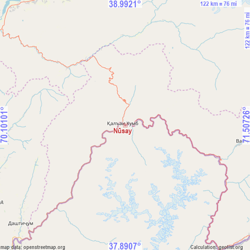
Nūsay GPS coordinates[2]
38° 26' 36.6" North, 70° 48' 14.868" East
| Map corner | latitude | longitude |
|---|---|---|
| Upper-left | 38.9921°, | 70.10101° |
| Center: | 38.4435°, | 70.80413° |
| Lower-right: | 37.8907°, | 71.50726° |
| Map W x H: | 122.5×122.5 km | = 76.1×76.1mi |
| max Lat: | 38.4435° ⇑0% North |
| Nūsay: | 38.4435° |
| min Lat: | ⇓100% South 30.15° |
| min Long | Nūsay | max Long |
| 61.06667° | 70.80413° | 72.318° |
| W 93.6%⇐ | ⇒6.4% E |
Elevation
Elevation of Nūsay is 1260 m = 4134 ft, and this is 158.4 m = 520 ft below average elevation for this country.
| Max E: |
3068 m = 10066 ft | 54.3% |
| Avg. | 1418.4 m = 4654 ft | |
| Nūsay | 1260 m = 4134 ft | |
Min E: |
254 m = 833 ft | 45.7% |
See also: Afghanistan elevation on elevation.city.
Geographical zone
Nūsay is located in North temperate zone (between Tropic of Cancer and the Arctic Circle). Distance of this Northern Tropic circle is 1668.6 km =1036.8 mi to South.| Distance of | km | miles | from Nūsay |
|---|---|---|---|
| North Pole | 5732.5 | 3562 | to North |
| Arctic Circle | 3126.7 | 1942.8 | to North |
| Tropic Cancer | 1668.6 | 1036.8 | to South |
| Equator | 4274.5 | 2656.1 | to South |


Nearby cities:
15 places around Nūsay: (largest is in red/bold)
• Bahārak
160.5 km =99.7 mi,  176°
176°
• Chāh Āb
145.1 km =90.2 mi,  216°
216°
• Chākarān
172 km =106.9 mi,  172°
172°
• Darqad
167.1 km =103.8 mi,  225°
225°
• Deh Khwāhān
80.1 km =49.8 mi, 219°
• Fayzabad
148.8 km =92.5 mi,  187°
187°
• March
106.4 km =66.1 mi,  197°
197°
• Māymay
20.8 km =12.9 mi,  100°
100°
• Pas Pul
109.1 km =67.8 mi, 188°
• Qal‘ah-ye Kūf
53.3 km =33.1 mi,  212°
212°
• Rustāq
169.6 km =105.4 mi, 210°
• Shahrān
162.8 km =101.2 mi, 182°
• Yangī Qal‘ah
150.8 km =93.7 mi, 223°
• Zīrakī
97.1 km =60.3 mi, 192°
• Ḩāfiz̧ Moghul
158.3 km =98.4 mi, 192°
Sources, notices
• [Note1] Compared only with cities in Afghanistan existing in our database
• [Src1] Map data: © OpenStreetMap contributors (CC-BY-SA)
• [Src2] Other city data from geonames.org with taken over terms of usage.
• [Src3] Geographical zone / Annual Mean Temperature by Robert A. Rohde @ Wikipedia
