Zīrakī geodata
Zīrakī (Badakhshan) is a seat of a second-order administrative division; located in Afghanistan in Asia/Kabul (GMT+4.5) time zone. In our database, there are 93 cities with bigger population. Compared to other cities in Afghanistan, 98.7% of cities are located further ↓South; 89.1% of cities are located further ←West and 93.6% of cities have lower elevation than Zīrakī. Note1


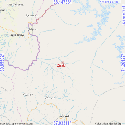
Zīrakī GPS coordinates[2]
37° 35' 32.388" North, 70° 33' 29.304" East
| Map corner | latitude | longitude |
|---|---|---|
| Upper-left | 38.14738°, | 69.85502° |
| Center: | 37.59233°, | 70.55814° |
| Lower-right: | 37.03311°, | 71.26127° |
| Map W x H: | 123.9×123.9 km | = 77×77mi |
| max Lat: | 38.4435° ⇑1.3% North |
| Zīrakī: | 37.59233° |
| min Lat: | ⇓98.7% South 30.15° |
| min Long | Zīrakī | max Long |
| 61.06667° | 70.55814° | 72.318° |
| W 89.1%⇐ | ⇒10.9% E |
Elevation
Elevation of Zīrakī is 2475 m = 8120 ft, and this is 1056.6 m = 3467 ft above average elevation for this country.
| Max E: |
3068 m = 10066 ft | 6.4% |
| Zīrakī | 2475 m 8120 ft | |
| Avg. | 1418.4 m = 4654 ft | |
Min E: |
254 m = 833 ft | 93.6% |
See also: Afghanistan elevation on elevation.city.
Geographical zone
Zīrakī is located in North temperate zone (between Tropic of Cancer and the Arctic Circle). Distance of this Northern Tropic circle is 1574 km =978 mi to South.| Distance of | km | miles | from Zīrakī |
|---|---|---|---|
| North Pole | 5827.2 | 3620.9 | to North |
| Arctic Circle | 3221.3 | 2001.6 | to North |
| Tropic Cancer | 1574 | 978 | to South |
| Equator | 4179.9 | 2597.3 | to South |


Nearby cities:
15 places around Zīrakī: (largest is in red/bold)
• Bahārak
72.5 km =45 mi,  154°
154°
• Bāzār-e Tashkān
82.9 km =51.5 mi,  197°
197°
• Chāh Āb
69.1 km =42.9 mi,  251°
251°
• Chākarān
88.2 km =54.8 mi, 149°
• Darāyim
82.2 km =51.1 mi,  190°
190°
• Deh Khwāhān
44.5 km =27.7 mi,  317°
317°
• Fayzabad
52.9 km =32.9 mi,  177°
177°
• Jurm
84.5 km =52.5 mi,  163°
163°
• March
12 km =7.5 mi,  233°
233°
• Pas Pul
14.2 km =8.8 mi, 158°
• Qal‘ah-ye Kūf
50.5 km =31.4 mi,  351°
351°
• Rustāq
82.6 km =51.3 mi, 231°
• Shahrān
70 km =43.5 mi,  166°
166°
• Yangī Qal‘ah
84.7 km =52.6 mi,  260°
260°
• Ḩāfiz̧ Moghul
61.2 km =38 mi, 193°
Sources, notices
• [Note1] Compared only with cities in Afghanistan existing in our database
• [Src1] Map data: © OpenStreetMap contributors (CC-BY-SA)
• [Src2] Other city data from geonames.org with taken over terms of usage.
• [Src3] Geographical zone / Annual Mean Temperature by Robert A. Rohde @ Wikipedia
