Shahrān geodata
Shahrān (Badakhshan) is a seat of a second-order administrative division; located in Afghanistan in Asia/Kabul (GMT+4.5) time zone. In our database, there are 93 cities with bigger population. Compared to other cities in Afghanistan, 91% of cities are located further ↓South; 91.6% of cities are located further ←West and 77.8% of cities have lower elevation than Shahrān. Note1


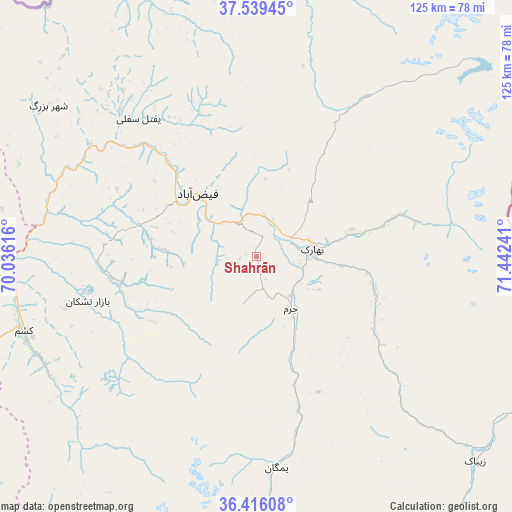
Shahrān GPS coordinates[2]
36° 58' 47.424" North, 70° 44' 21.408" East
| Map corner | latitude | longitude |
|---|---|---|
| Upper-left | 37.53945°, | 70.03616° |
| Center: | 36.97984°, | 70.73928° |
| Lower-right: | 36.41608°, | 71.44241° |
| Map W x H: | 124.9×124.9 km | = 77.6×77.6mi |
| max Lat: | 38.4435° ⇑9% North |
| Shahrān: | 36.97984° |
| min Lat: | ⇓91% South 30.15° |
| min Long | Shahrān | max Long |
| 61.06667° | 70.73928° | 72.318° |
| W 91.6%⇐ | ⇒8.4% E |
Elevation
Elevation of Shahrān is 2093 m = 6867 ft, and this is 674.6 m = 2213 ft above average elevation for this country.
| Max E: |
3068 m = 10066 ft | 22.2% |
| Shahrān | 2093 m 6867 ft | |
| Avg. | 1418.4 m = 4654 ft | |
Min E: |
254 m = 833 ft | 77.8% |
See also: Afghanistan elevation on elevation.city.
Geographical zone
Shahrān is located in North temperate zone (between Tropic of Cancer and the Arctic Circle). Distance of this Northern Tropic circle is 1505.9 km =935.7 mi to South.| Distance of | km | miles | from Shahrān |
|---|---|---|---|
| North Pole | 5895.3 | 3663.2 | to North |
| Arctic Circle | 3289.4 | 2043.9 | to North |
| Tropic Cancer | 1505.9 | 935.7 | to South |
| Equator | 4111.8 | 2555 | to South |


Nearby cities:
15 places around Shahrān: (largest is in red/bold)
• Ashkāsham
78 km =48.5 mi,  115°
115°
• Bahārak
15.1 km =9.4 mi,  80°
80°
• Bāzār-e Tashkān
42.5 km =26.4 mi,  255°
255°
• Chākarān
30.3 km =18.8 mi,  104°
104°
• Darāyim
34.1 km =21.2 mi,  248°
248°
• Fayzabad
20.8 km =12.9 mi,  317°
317°
• Ghurayd Gharamē
51.1 km =31.8 mi,  174°
174°
• Jurm
15.3 km =9.5 mi,  146°
146°
• Kalafgān
74.3 km =46.2 mi, 251°
• March
66.2 km =41.1 mi,  337°
337°
• Mashhad
59.5 km =37 mi, 252°
• Pas Pul
56 km =34.8 mi,  348°
348°
• Zaybāk
73.6 km =45.7 mi,  132°
132°
• Zīrakī
70 km =43.5 mi, 346°
• Ḩāfiz̧ Moghul
31.2 km =19.4 mi,  285°
285°
Sources, notices
• [Note1] Compared only with cities in Afghanistan existing in our database
• [Src1] Map data: © OpenStreetMap contributors (CC-BY-SA)
• [Src2] Other city data from geonames.org with taken over terms of usage.
• [Src3] Geographical zone / Annual Mean Temperature by Robert A. Rohde @ Wikipedia
