Chākarān geodata
Chākarān (Badakhshan) is a seat of a second-order administrative division; located in Afghanistan in Asia/Kabul (GMT+4.5) time zone. In our database, there are 93 cities with bigger population. Compared to other cities in Afghanistan, 89.7% of cities are located further ↓South; 96.5% of cities are located further ←West and 64.6% of cities have lower elevation than Chākarān. Note1


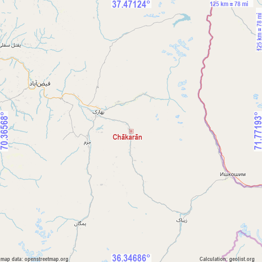
Chākarān GPS coordinates[2]
36° 54' 40.032" North, 71° 4' 7.68" East
| Map corner | latitude | longitude |
|---|---|---|
| Upper-left | 37.47124°, | 70.36568° |
| Center: | 36.91112°, | 71.0688° |
| Lower-right: | 36.34686°, | 71.77193° |
| Map W x H: | 125×125 km | = 77.7×77.7mi |
| max Lat: | 38.4435° ⇑10.3% North |
| Chākarān: | 36.91112° |
| min Lat: | ⇓89.7% South 30.15° |
| min Long | Chākarān | max Long |
| 61.06667° | 71.0688° | 72.318° |
| W 96.5%⇐ | ⇒3.5% E |
Elevation
Elevation of Chākarān is 1759 m = 5771 ft, and this is 340.6 m = 1117 ft above average elevation for this country.
| Max E: |
3068 m = 10066 ft | 35.4% |
| Chākarān | 1759 m 5771 ft | |
| Avg. | 1418.4 m = 4654 ft | |
Min E: |
254 m = 833 ft | 64.6% |
See also: Afghanistan elevation on elevation.city.
Geographical zone
Chākarān is located in North temperate zone (between Tropic of Cancer and the Arctic Circle). Distance of this Northern Tropic circle is 1498.2 km =930.9 mi to South.| Distance of | km | miles | from Chākarān |
|---|---|---|---|
| North Pole | 5902.9 | 3667.9 | to North |
| Arctic Circle | 3297 | 2048.7 | to North |
| Tropic Cancer | 1498.2 | 930.9 | to South |
| Equator | 4104.1 | 2550.2 | to South |


Nearby cities:
15 places around Chākarān: (largest is in red/bold)
• Ashkāsham
48.5 km =30.1 mi,  121°
121°
• Bahārak
17.6 km =10.9 mi,  305°
305°
• Bāzār-e Tashkān
70.5 km =43.8 mi,  267°
267°
• Darāyim
61.2 km =38 mi, 265°
• Fayzabad
49 km =30.4 mi,  297°
297°
• Ghurayd Gharamē
49.8 km =30.9 mi,  209°
209°
• Jurm
21.5 km =13.4 mi,  256°
256°
• Kalafgān
101.2 km =62.9 mi, 261°
• March
87.9 km =54.6 mi,  321°
321°
• Mashhad
86.6 km =53.8 mi, 263°
• Pas Pul
74.3 km =46.2 mi,  327°
327°
• Shahrān
30.3 km =18.8 mi,  284°
284°
• Zaybāk
49 km =30.4 mi,  149°
149°
• Zīrakī
88.2 km =54.8 mi, 329°
• Ḩāfiz̧ Moghul
61.5 km =38.2 mi,  285°
285°
Sources, notices
• [Note1] Compared only with cities in Afghanistan existing in our database
• [Src1] Map data: © OpenStreetMap contributors (CC-BY-SA)
• [Src2] Other city data from geonames.org with taken over terms of usage.
• [Src3] Geographical zone / Annual Mean Temperature by Robert A. Rohde @ Wikipedia
