Pas Pul geodata
Pas Pul (Badakhshan) is a seat of a second-order administrative division; located in Afghanistan in Asia/Kabul (GMT+4.5) time zone. In our database, there are 93 cities with bigger population. Compared to other cities in Afghanistan, 97.7% of cities are located further ↓South; 90.4% of cities are located further ←West and 81% of cities have lower elevation than Pas Pul. Note1


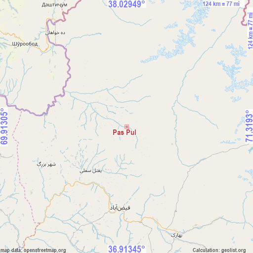
Pas Pul GPS coordinates[2]
37° 28' 24.78" North, 70° 36' 58.212" East
| Map corner | latitude | longitude |
|---|---|---|
| Upper-left | 38.02949°, | 69.91305° |
| Center: | 37.47355°, | 70.61617° |
| Lower-right: | 36.91345°, | 71.3193° |
| Map W x H: | 124.1×124.1 km | = 77.1×77.1mi |
| max Lat: | 38.4435° ⇑2.3% North |
| Pas Pul: | 37.47355° |
| min Lat: | ⇓97.7% South 30.15° |
| min Long | Pas Pul | max Long |
| 61.06667° | 70.61617° | 72.318° |
| W 90.4%⇐ | ⇒9.6% E |
Elevation
Elevation of Pas Pul is 2143 m = 7031 ft, and this is 724.6 m = 2377 ft above average elevation for this country.
| Max E: |
3068 m = 10066 ft | 19% |
| Pas Pul | 2143 m 7031 ft | |
| Avg. | 1418.4 m = 4654 ft | |
Min E: |
254 m = 833 ft | 81% |
See also: Afghanistan elevation on elevation.city.
Geographical zone
Pas Pul is located in North temperate zone (between Tropic of Cancer and the Arctic Circle). Distance of this Northern Tropic circle is 1560.7 km =969.8 mi to South.| Distance of | km | miles | from Pas Pul |
|---|---|---|---|
| North Pole | 5840.4 | 3629.1 | to North |
| Arctic Circle | 3234.5 | 2009.8 | to North |
| Tropic Cancer | 1560.7 | 969.8 | to South |
| Equator | 4166.7 | 2589.1 | to South |


Nearby cities:
15 places around Pas Pul: (largest is in red/bold)
• Bahārak
58.3 km =36.2 mi,  153°
153°
• Bāzār-e Tashkān
72.4 km =45 mi,  204°
204°
• Chāh Āb
71.3 km =44.3 mi,  263°
263°
• Chākarān
74.3 km =46.2 mi, 147°
• Darāyim
70.6 km =43.9 mi, 196°
• Deh Khwāhān
58 km =36 mi,  322°
322°
• Fayzabad
39.8 km =24.7 mi,  184°
184°
• Jurm
70.4 km =43.7 mi,  164°
164°
• March
16 km =9.9 mi,  292°
292°
• Mashhad
86.1 km =53.5 mi,  211°
211°
• Qal‘ah-ye Kūf
64.4 km =40 mi,  348°
348°
• Rustāq
79.5 km =49.4 mi,  240°
240°
• Shahrān
56 km =34.8 mi,  168°
168°
• Zīrakī
14.2 km =8.8 mi,  338°
338°
• Ḩāfiz̧ Moghul
50.1 km =31.1 mi, 202°
Sources, notices
• [Note1] Compared only with cities in Afghanistan existing in our database
• [Src1] Map data: © OpenStreetMap contributors (CC-BY-SA)
• [Src2] Other city data from geonames.org with taken over terms of usage.
• [Src3] Geographical zone / Annual Mean Temperature by Robert A. Rohde @ Wikipedia
