Māymay geodata
Māymay (Badakhshan) is a seat of a second-order administrative division; located in Afghanistan in Asia/Kabul (GMT+4.5) time zone. In our database, there are 93 cities with bigger population. Compared to other cities in Afghanistan, 99.7% of cities are located further ↓South; 95.8% of cities are located further ←West and 60.5% of cities have lower elevation than Māymay. Note1


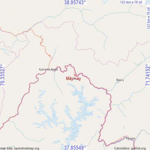
Māymay GPS coordinates[2]
38° 24' 30.816" North, 71° 2' 18.204" East
| Map corner | latitude | longitude |
|---|---|---|
| Upper-left | 38.95743°, | 70.33527° |
| Center: | 38.40856°, | 71.03839° |
| Lower-right: | 37.85549°, | 71.74152° |
| Map W x H: | 122.5×122.5 km | = 76.1×76.1mi |
| max Lat: | 38.4435° ⇑0.3% North |
| Māymay: | 38.40856° |
| min Lat: | ⇓99.7% South 30.15° |
| min Long | Māymay | max Long |
| 61.06667° | 71.03839° | 72.318° |
| W 95.8%⇐ | ⇒4.2% E |
Elevation
Elevation of Māymay is 1636 m = 5367 ft, and this is 217.6 m = 714 ft above average elevation for this country.
| Max E: |
3068 m = 10066 ft | 39.5% |
| Māymay | 1636 m 5367 ft | |
| Avg. | 1418.4 m = 4654 ft | |
Min E: |
254 m = 833 ft | 60.5% |
See also: Afghanistan elevation on elevation.city.
Geographical zone
Māymay is located in North temperate zone (between Tropic of Cancer and the Arctic Circle). Distance of this Northern Tropic circle is 1664.7 km =1034.4 mi to South.| Distance of | km | miles | from Māymay |
|---|---|---|---|
| North Pole | 5736.4 | 3564.4 | to North |
| Arctic Circle | 3130.5 | 1945.2 | to North |
| Tropic Cancer | 1664.7 | 1034.4 | to South |
| Equator | 4270.6 | 2653.6 | to South |


Nearby cities:
15 places around Māymay: (largest is in red/bold)
• Bahārak
156.8 km =97.4 mi,  184°
184°
• Chāh Āb
155.4 km =96.6 mi,  223°
223°
• Chākarān
166.5 km =103.5 mi, 179°
• Deh Khwāhān
92 km =57.2 mi,  231°
231°
• Fayzabad
149.2 km =92.7 mi,  195°
195°
• Jurm
172.6 km =107.2 mi,  185°
185°
• March
110.7 km =68.8 mi,  207°
207°
• Nūsay
20.8 km =12.9 mi,  280°
280°
• Pas Pul
110.4 km =68.6 mi, 199°
• Qal‘ah-ye Kūf
64.1 km =39.8 mi, 230°
• Rustāq
177.8 km =110.5 mi, 216°
• Shahrān
161 km =100 mi, 189°
• Yangī Qal‘ah
163.2 km =101.4 mi, 230°
• Zīrakī
100 km =62.1 mi, 204°
• Ḩāfiz̧ Moghul
160.5 km =99.7 mi, 200°
Sources, notices
• [Note1] Compared only with cities in Afghanistan existing in our database
• [Src1] Map data: © OpenStreetMap contributors (CC-BY-SA)
• [Src2] Other city data from geonames.org with taken over terms of usage.
• [Src3] Geographical zone / Annual Mean Temperature by Robert A. Rohde @ Wikipedia
