Deh Khwāhān geodata
Deh Khwāhān (Badakhshan) is a seat of a second-order administrative division; located in Afghanistan in Asia/Kabul (GMT+4.5) time zone. In our database, there are 93 cities with bigger population. Compared to other cities in Afghanistan, 99% of cities are located further ↓South; 84.9% of cities are located further ←West and 64% of cities have higher elevation than Deh Khwāhān. Note1


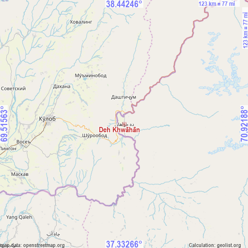
Deh Khwāhān GPS coordinates[2]
37° 53' 22.74" North, 70° 13' 7.5" East
| Map corner | latitude | longitude |
|---|---|---|
| Upper-left | 38.44246°, | 69.51563° |
| Center: | 37.88965°, | 70.21875° |
| Lower-right: | 37.33266°, | 70.92188° |
| Map W x H: | 123.4×123.4 km | = 76.7×76.7mi |
| max Lat: | 38.4435° ⇑1% North |
| Deh Khwāhān: | 37.88965° |
| min Lat: | ⇓99% South 30.15° |
| min Long | Deh Khwāhān | max Long |
| 61.06667° | 70.21875° | 72.318° |
| W 84.9%⇐ | ⇒15.1% E |
Elevation
Elevation of Deh Khwāhān is 1047 m = 3435 ft, and this is 371.4 m = 1219 ft below average elevation for this country.
| Max E: |
3068 m = 10066 ft | 64% |
| Avg. | 1418.4 m = 4654 ft | |
| Deh Khwāhān | 1047 m = 3435 ft | |
Min E: |
254 m = 833 ft | 36% |
See also: Afghanistan elevation on elevation.city.
Geographical zone
Deh Khwāhān is located in North temperate zone (between Tropic of Cancer and the Arctic Circle). Distance of this Northern Tropic circle is 1607 km =998.5 mi to South.| Distance of | km | miles | from Deh Khwāhān |
|---|---|---|---|
| North Pole | 5794.1 | 3600.3 | to North |
| Arctic Circle | 3188.2 | 1981.1 | to North |
| Tropic Cancer | 1607 | 998.5 | to South |
| Equator | 4212.9 | 2617.8 | to South |


Nearby cities:
15 places around Deh Khwāhān: (largest is in red/bold)
• Chāh Āb
65.2 km =40.5 mi,  213°
213°
• Darqad
87.8 km =54.6 mi,  230°
230°
• Dasht-e Qal‘ah
106.6 km =66.2 mi,  219°
219°
• Fayzabad
91.7 km =57 mi,  159°
159°
• March
44.9 km =27.9 mi,  153°
153°
• Māymay
92 km =57.2 mi,  51°
51°
• Nūsay
80.1 km =49.8 mi,  39°
39°
• Pas Pul
58 km =36 mi,  142°
142°
• Qal‘ah-ye Kūf
27.9 km =17.3 mi, 52°
• Rustāq
91.6 km =56.9 mi,  201°
201°
• Shahrān
111.1 km =69 mi, 155°
• Yangī Qal‘ah
71.3 km =44.3 mi, 228°
• Zīrakī
44.5 km =27.7 mi, 137°
• Ārt Khwājah
110.6 km =68.7 mi, 216°
• Ḩāfiz̧ Moghul
94 km =58.4 mi,  170°
170°
Sources, notices
• [Note1] Compared only with cities in Afghanistan existing in our database
• [Src1] Map data: © OpenStreetMap contributors (CC-BY-SA)
• [Src2] Other city data from geonames.org with taken over terms of usage.
• [Src3] Geographical zone / Annual Mean Temperature by Robert A. Rohde @ Wikipedia
