Dū Qal‘ah geodata
Dū Qal‘ah (Farah) is a seat of a second-order administrative division; located in Afghanistan in Asia/Kabul (GMT+4.5) time zone. In our database, there are 93 cities with bigger population. Compared to other cities in Afghanistan, 91.6% of cities are located further ↑North; 99% of cities are located further →East and 85.9% of cities have higher elevation than Dū Qal‘ah. Note1


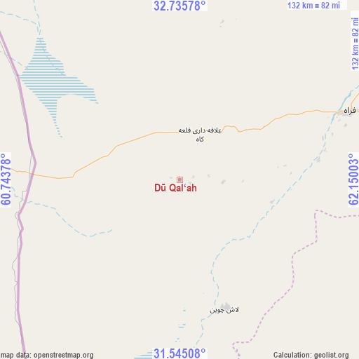
Dū Qal‘ah GPS coordinates[2]
32° 8' 32.532" North, 61° 26' 48.84" East
| Map corner | latitude | longitude |
|---|---|---|
| Upper-left | 32.73578°, | 60.74378° |
| Center: | 32.14237°, | 61.4469° |
| Lower-right: | 31.54508°, | 62.15003° |
| Map W x H: | 132.4×132.4 km | = 82.3×82.3mi |
| max Lat: | 38.4435° ⇑91.6% North |
| Dū Qal‘ah: | 32.14237° |
| min Lat: | ⇓8.4% South 30.15° |
| min Long | Dū Qal‘ah | max Long |
| 61.06667° | 61.4469° | 72.318° |
| W 1%⇐ | ⇒99% E |
Elevation
Elevation of Dū Qal‘ah is 557 m = 1827 ft, and this is 861.4 m = 2826 ft below average elevation for this country.
| Max E: |
3068 m = 10066 ft | 85.9% |
| Avg. | 1418.4 m = 4654 ft | |
| Dū Qal‘ah | 557 m = 1827 ft | |
Min E: |
254 m = 833 ft | 14.1% |
See also: Afghanistan elevation on elevation.city.
Geographical zone
Dū Qal‘ah is located in North temperate zone (between Tropic of Cancer and the Arctic Circle). Distance of this Northern Tropic circle is 968 km =601.5 mi to South.| Distance of | km | miles | from Dū Qal‘ah |
|---|---|---|---|
| North Pole | 6433.2 | 3997.4 | to North |
| Arctic Circle | 3827.3 | 2378.2 | to North |
| Tropic Cancer | 968 | 601.5 | to South |
| Equator | 3573.9 | 2220.7 | to South |


Nearby cities:
15 places around Dū Qal‘ah: (largest is in red/bold)
• Adraskan
184 km =114.3 mi,  24°
24°
• Anār Darah
71.2 km =44.2 mi, 15°
• Chahār Burj
243.8 km =151.5 mi, 16°
• Farah
68 km =42.3 mi,  67°
67°
• Guz̄arah
240.9 km =149.7 mi, 17°
• Khāsh
144.1 km =89.5 mi,  118°
118°
• Kushk
136.7 km =84.9 mi, 20°
• Kushkak
17.9 km =11.1 mi, 23°
• Lāsh-e Juwayn
50.5 km =31.4 mi,  160°
160°
• Markaz-e Ḩukūmat-e Sulţān-e Bakwāh
141.8 km =88.1 mi,  85°
85°
• Mīrābād
193.3 km =120.1 mi,  168°
168°
• Qal‘ah-ye Kuhnah
215 km =133.6 mi,  75°
75°
• Shīnḏanḏ
144.7 km =89.9 mi,  26°
26°
• Wāshēr
226.9 km =141 mi, 86°
• Zaranj
137.2 km =85.3 mi, 163°
Sources, notices
• [Note1] Compared only with cities in Afghanistan existing in our database
• [Src1] Map data: © OpenStreetMap contributors (CC-BY-SA)
• [Src2] Other city data from geonames.org with taken over terms of usage.
• [Src3] Geographical zone / Annual Mean Temperature by Robert A. Rohde @ Wikipedia
