Anār Darah geodata
Anār Darah (Farah) is a seat of a second-order administrative division; located in Afghanistan in Asia/Kabul (GMT+4.5) time zone. With population of 10,023 people, there are 68 cities with bigger population in this country. Compared to other cities in Afghanistan, 85.9% of cities are located further ↑North; 97.7% of cities are located further →East and 78.1% of cities have higher elevation than Anār Darah. Note1


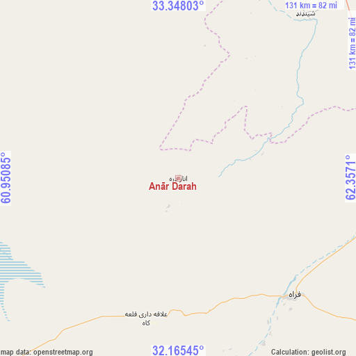
Anār Darah GPS coordinates[2]
32° 45' 31.32" North, 61° 39' 14.292" East
| Map corner | latitude | longitude |
|---|---|---|
| Upper-left | 33.34803°, | 60.95085° |
| Center: | 32.7587°, | 61.65397° |
| Lower-right: | 32.16545°, | 62.3571° |
| Map W x H: | 131.5×131.5 km | = 81.7×81.7mi |
| max Lat: | 38.4435° ⇑85.9% North |
| Anār Darah: | 32.7587° |
| min Lat: | ⇓14.1% South 30.15° |
| min Long | Anār Darah | max Long |
| 61.06667° | 61.65397° | 72.318° |
| W 2.3%⇐ | ⇒97.7% E |
Elevation
Elevation of Anār Darah is 778 m = 2552 ft, and this is 640.4 m = 2101 ft below average elevation for this country.
| Max E: |
3068 m = 10066 ft | 78.1% |
| Avg. | 1418.4 m = 4654 ft | |
| Anār Darah | 778 m = 2552 ft | |
Min E: |
254 m = 833 ft | 21.9% |
See also: Afghanistan elevation on elevation.city.
Geographical zone
Anār Darah is located in North temperate zone (between Tropic of Cancer and the Arctic Circle). Distance of this Northern Tropic circle is 1036.5 km =644.1 mi to South.| Distance of | km | miles | from Anār Darah |
|---|---|---|---|
| North Pole | 6364.6 | 3954.8 | to North |
| Arctic Circle | 3758.7 | 2335.5 | to North |
| Tropic Cancer | 1036.5 | 644.1 | to South |
| Equator | 3642.4 | 2263.3 | to South |


Nearby cities:
15 places around Anār Darah: (largest is in red/bold)
• Adraskan
114.1 km =70.9 mi,  30°
30°
• Chahār Burj
172.6 km =107.2 mi,  16°
16°
• Dū Qal‘ah
71.2 km =44.2 mi,  195°
195°
• Farah
60.8 km =37.8 mi,  134°
134°
• Ghōriyān
177 km =110 mi,  355°
355°
• Guz̄arah
169.7 km =105.4 mi, 17°
• Herāt
183.8 km =114.2 mi, 15°
• Injīl
180.1 km =111.9 mi, 17°
• Khāsh
173.6 km =107.9 mi,  141°
141°
• Kushk
65.9 km =40.9 mi, 24°
• Kushkak
53.6 km =33.3 mi,  193°
193°
• Lāsh-e Juwayn
116.2 km =72.2 mi,  181°
181°
• Markaz-e Ḩukūmat-e Sulţān-e Bakwāh
134.4 km =83.5 mi,  115°
115°
• Shīnḏanḏ
76 km =47.2 mi,  37°
37°
• Zindah Jān
176.3 km =109.5 mi,  2°
2°
Sources, notices
• [Note1] Compared only with cities in Afghanistan existing in our database
• [Src1] Map data: © OpenStreetMap contributors (CC-BY-SA)
• [Src2] Other city data from geonames.org with taken over terms of usage.
• [Src3] Geographical zone / Annual Mean Temperature by Robert A. Rohde @ Wikipedia
