Kushkak geodata
Kushkak (Farah) is a seat of a second-order administrative division; located in Afghanistan in Asia/Kabul (GMT+4.5) time zone. In our database, there are 93 cities with bigger population. Compared to other cities in Afghanistan, 90.4% of cities are located further ↑North; 98.4% of cities are located further →East and 84.2% of cities have higher elevation than Kushkak. Note1


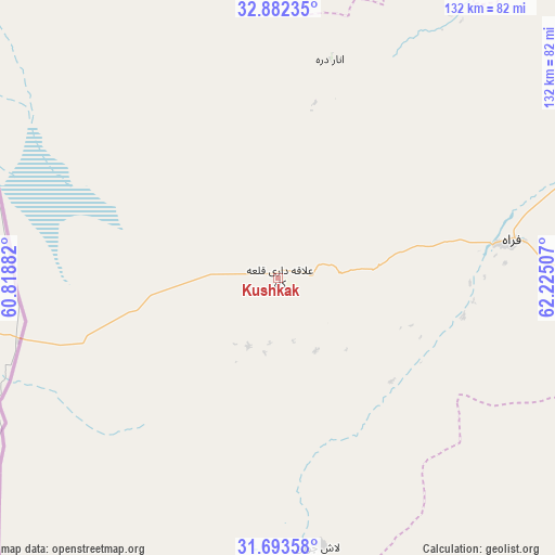
Kushkak GPS coordinates[2]
32° 17' 23.676" North, 61° 31' 18.984" East
| Map corner | latitude | longitude |
|---|---|---|
| Upper-left | 32.88235°, | 60.81882° |
| Center: | 32.28991°, | 61.52194° |
| Lower-right: | 31.69358°, | 62.22507° |
| Map W x H: | 132.2×132.2 km | = 82.1×82.1mi |
| max Lat: | 38.4435° ⇑90.4% North |
| Kushkak: | 32.28991° |
| min Lat: | ⇓9.6% South 30.15° |
| min Long | Kushkak | max Long |
| 61.06667° | 61.52194° | 72.318° |
| W 1.6%⇐ | ⇒98.4% E |
Elevation
Elevation of Kushkak is 612 m = 2008 ft, and this is 806.4 m = 2646 ft below average elevation for this country.
| Max E: |
3068 m = 10066 ft | 84.2% |
| Avg. | 1418.4 m = 4654 ft | |
| Kushkak | 612 m = 2008 ft | |
Min E: |
254 m = 833 ft | 15.8% |
See also: Afghanistan elevation on elevation.city.
Geographical zone
Kushkak is located in North temperate zone (between Tropic of Cancer and the Arctic Circle). Distance of this Northern Tropic circle is 984.4 km =611.7 mi to South.| Distance of | km | miles | from Kushkak |
|---|---|---|---|
| North Pole | 6416.8 | 3987.2 | to North |
| Arctic Circle | 3810.9 | 2368 | to North |
| Tropic Cancer | 984.4 | 611.7 | to South |
| Equator | 3590.3 | 2230.9 | to South |


Nearby cities:
15 places around Kushkak: (largest is in red/bold)
• Adraskan
166.1 km =103.2 mi,  24°
24°
• Anār Darah
53.6 km =33.3 mi,  13°
13°
• Chahār Burj
226.1 km =140.5 mi, 15°
• Dū Qal‘ah
17.9 km =11.1 mi,  203°
203°
• Farah
56.6 km =35.2 mi,  80°
80°
• Guz̄arah
223.2 km =138.7 mi, 16°
• Khāsh
146.6 km =91.1 mi,  125°
125°
• Kushk
118.8 km =73.8 mi, 19°
• Lāsh-e Juwayn
64.8 km =40.3 mi,  171°
171°
• Markaz-e Ḩukūmat-e Sulţān-e Bakwāh
134.3 km =83.5 mi,  92°
92°
• Mīrābād
208.3 km =129.4 mi, 171°
• Qal‘ah-ye Kuhnah
204.5 km =127.1 mi, 79°
• Shīnḏanḏ
126.9 km =78.9 mi,  27°
27°
• Wāshēr
219.4 km =136.3 mi, 91°
• Zaranj
151.3 km =94 mi, 167°
Sources, notices
• [Note1] Compared only with cities in Afghanistan existing in our database
• [Src1] Map data: © OpenStreetMap contributors (CC-BY-SA)
• [Src2] Other city data from geonames.org with taken over terms of usage.
• [Src3] Geographical zone / Annual Mean Temperature by Robert A. Rohde @ Wikipedia
