Qal‘ah-ye Fārsī geodata
Qal‘ah-ye Fārsī (Herat) is a seat of a second-order administrative division; located in Afghanistan in Asia/Kabul (GMT+4.5) time zone. In our database, there are 93 cities with bigger population. Compared to other cities in Afghanistan, 69.8% of cities are located further ↑North; 90.4% of cities are located further →East and 86.5% of cities have lower elevation than Qal‘ah-ye Fārsī. Note1


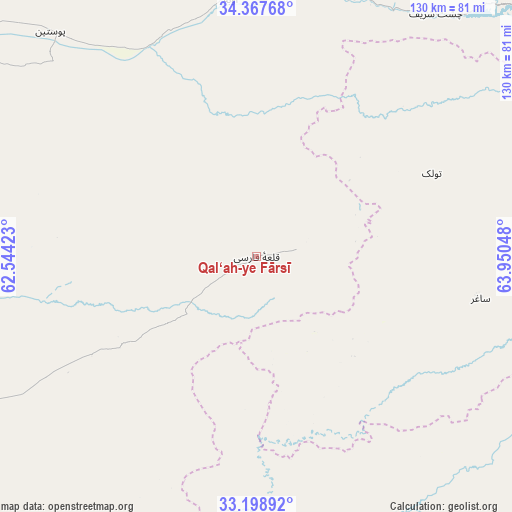
Qal‘ah-ye Fārsī GPS coordinates[2]
33° 47' 7.044" North, 63° 14' 50.46" East
| Map corner | latitude | longitude |
|---|---|---|
| Upper-left | 34.36768°, | 62.54423° |
| Center: | 33.78529°, | 63.24735° |
| Lower-right: | 33.19892°, | 63.95048° |
| Map W x H: | 130×130 km | = 80.8×80.8mi |
| max Lat: | 38.4435° ⇑69.8% North |
| Qal‘ah-ye Fārsī: | 33.78529° |
| min Lat: | ⇓30.2% South 30.15° |
| min Long | Qal‘ah-ye Fā | max Long |
| 61.06667° | 63.24735° | 72.318° |
| W 9.6%⇐ | ⇒90.4% E |
Elevation
Elevation of Qal‘ah-ye Fārsī is 2286 m = 7500 ft, and this is 867.6 m = 2846 ft above average elevation for this country.
| Max E: |
3068 m = 10066 ft | 13.5% |
| Qal‘ah-ye Fārsī | 2286 m 7500 ft | |
| Avg. | 1418.4 m = 4654 ft | |
Min E: |
254 m = 833 ft | 86.5% |
See also: Afghanistan elevation on elevation.city.
Geographical zone
Qal‘ah-ye Fārsī is located in North temperate zone (between Tropic of Cancer and the Arctic Circle). Distance of this Northern Tropic circle is 1150.7 km =715 mi to South.| Distance of | km | miles | from Qal‘ah-ye Fārsī |
|---|---|---|---|
| North Pole | 6250.5 | 3883.9 | to North |
| Arctic Circle | 3644.6 | 2264.6 | to North |
| Tropic Cancer | 1150.7 | 715 | to South |
| Equator | 3756.6 | 2334.2 | to South |


Nearby cities:
15 places around Qal‘ah-ye Fārsī: (largest is in red/bold)
• Adraskan
91.8 km =57 mi,  260°
260°
• Chahār Burj
109.9 km =68.3 mi,  297°
297°
• Chisht-e Sharīf
77.2 km =48 mi,  35°
35°
• Dasht-e Qal‘ah
100.4 km =62.4 mi,  146°
146°
• Guz̄arah
106.6 km =66.2 mi, 296°
• Herāt
115 km =71.5 mi, 302°
• Injīl
108.6 km =67.5 mi, 301°
• Karukh
98.4 km =61.1 mi,  321°
321°
• Qaryeh-ye Owbeh
65.3 km =40.6 mi,  354°
354°
• Qādis
115 km =71.5 mi,  8°
8°
• Shahrak
103.9 km =64.6 mi,  69°
69°
• Shīnḏanḏ
115.2 km =71.6 mi,  242°
242°
• Taywarah
112.5 km =69.9 mi,  105°
105°
• Tītān
58 km =36 mi,  100°
100°
• Tūlak
49.2 km =30.6 mi,  64°
64°
Sources, notices
• [Note1] Compared only with cities in Afghanistan existing in our database
• [Src1] Map data: © OpenStreetMap contributors (CC-BY-SA)
• [Src2] Other city data from geonames.org with taken over terms of usage.
• [Src3] Geographical zone / Annual Mean Temperature by Robert A. Rohde @ Wikipedia
