Shahrak geodata
Shahrak (Ghowr) is a seat of a second-order administrative division; located in Afghanistan in Asia/Kabul (GMT+4.5) time zone. With population of 15,967 people, there are 41 cities with bigger population in this country. Compared to other cities in Afghanistan, 65% of cities are located further ↑North; 85.2% of cities are located further →East and 89.7% of cities have lower elevation than Shahrak. Note1


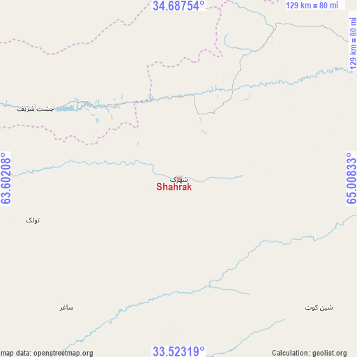
Shahrak GPS coordinates[2]
34° 6' 26.532" North, 64° 18' 18.72" East
| Map corner | latitude | longitude |
|---|---|---|
| Upper-left | 34.68754°, | 63.60208° |
| Center: | 34.10737°, | 64.3052° |
| Lower-right: | 33.52319°, | 65.00833° |
| Map W x H: | 129.5×129.5 km | = 80.5×80.5mi |
| max Lat: | 38.4435° ⇑65% North |
| Shahrak: | 34.10737° |
| min Lat: | ⇓35% South 30.15° |
| min Long | Shahrak | max Long |
| 61.06667° | 64.3052° | 72.318° |
| W 14.8%⇐ | ⇒85.2% E |
Elevation
Elevation of Shahrak is 2357 m = 7733 ft, and this is 938.6 m = 3079 ft above average elevation for this country.
| Max E: |
3068 m = 10066 ft | 10.3% |
| Shahrak | 2357 m 7733 ft | |
| Avg. | 1418.4 m = 4654 ft | |
Min E: |
254 m = 833 ft | 89.7% |
See also: Afghanistan elevation on elevation.city.
Geographical zone
Shahrak is located in North temperate zone (between Tropic of Cancer and the Arctic Circle). Distance of this Northern Tropic circle is 1186.5 km =737.3 mi to South.| Distance of | km | miles | from Shahrak |
|---|---|---|---|
| North Pole | 6214.7 | 3861.6 | to North |
| Arctic Circle | 3608.8 | 2242.4 | to North |
| Tropic Cancer | 1186.5 | 737.3 | to South |
| Equator | 3792.4 | 2356.5 | to South |


Nearby cities:
15 places around Shahrak: (largest is in red/bold)
• Chisht-e Sharīf
58.4 km =36.3 mi,  297°
297°
• Dasht-e Qal‘ah
127.3 km =79.1 mi,  199°
199°
• Dowlatyār
145.3 km =90.3 mi,  70°
70°
• Dū Laīnah
44.5 km =27.7 mi,  83°
83°
• Fayrōz Kōh
98.2 km =61 mi,  62°
62°
• Jawand
107.3 km =66.7 mi,  352°
352°
• Pasāband
68.7 km =42.7 mi,  132°
132°
• Qala i Naw
145.5 km =90.4 mi,  312°
312°
• Qal‘ah-ye Fārsī
103.9 km =64.6 mi,  249°
249°
• Qaryeh-ye Owbeh
107.8 km =67 mi,  285°
285°
• Qādis
111.9 km =69.5 mi, 314°
• Sar-e Tayghān
143 km =88.9 mi,  117°
117°
• Taywarah
66.1 km =41.1 mi,  170°
170°
• Tītān
61.7 km =38.3 mi,  221°
221°
• Tūlak
55.1 km =34.2 mi, 254°
Sources, notices
• [Note1] Compared only with cities in Afghanistan existing in our database
• [Src1] Map data: © OpenStreetMap contributors (CC-BY-SA)
• [Src2] Other city data from geonames.org with taken over terms of usage.
• [Src3] Geographical zone / Annual Mean Temperature by Robert A. Rohde @ Wikipedia
