Tītān geodata
Tītān (Ghowr) is a seat of a second-order administrative division; located in Afghanistan in Asia/Kabul (GMT+4.5) time zone. In our database, there are 93 cities with bigger population. Compared to other cities in Afghanistan, 70.7% of cities are located further ↑North; 86.8% of cities are located further →East and 83.6% of cities have lower elevation than Tītān. Note1


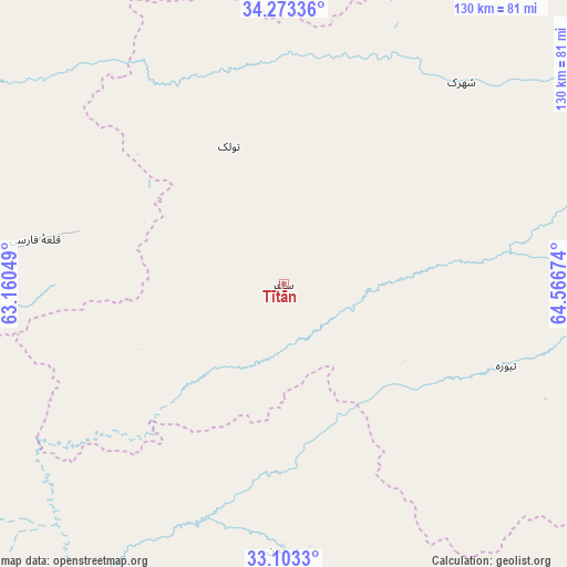
Tītān GPS coordinates[2]
33° 41' 25.152" North, 63° 51' 48.996" East
| Map corner | latitude | longitude |
|---|---|---|
| Upper-left | 34.27336°, | 63.16049° |
| Center: | 33.69032°, | 63.86361° |
| Lower-right: | 33.1033°, | 64.56674° |
| Map W x H: | 130.1×130.1 km | = 80.8×80.8mi |
| max Lat: | 38.4435° ⇑70.7% North |
| Tītān: | 33.69032° |
| min Lat: | ⇓29.3% South 30.15° |
| min Long | Tītān | max Long |
| 61.06667° | 63.86361° | 72.318° |
| W 13.2%⇐ | ⇒86.8% E |
Elevation
Elevation of Tītān is 2194 m = 7198 ft, and this is 775.6 m = 2545 ft above average elevation for this country.
| Max E: |
3068 m = 10066 ft | 16.4% |
| Tītān | 2194 m 7198 ft | |
| Avg. | 1418.4 m = 4654 ft | |
Min E: |
254 m = 833 ft | 83.6% |
See also: Afghanistan elevation on elevation.city.
Geographical zone
Tītān is located in North temperate zone (between Tropic of Cancer and the Arctic Circle). Distance of this Northern Tropic circle is 1140.1 km =708.4 mi to South.| Distance of | km | miles | from Tītān |
|---|---|---|---|
| North Pole | 6261 | 3890.4 | to North |
| Arctic Circle | 3655.2 | 2271.2 | to North |
| Tropic Cancer | 1140.1 | 708.4 | to South |
| Equator | 3746 | 2327.7 | to South |


Nearby cities:
15 places around Tītān: (largest is in red/bold)
• Adraskan
147.6 km =91.7 mi,  268°
268°
• Chisht-e Sharīf
73.9 km =45.9 mi,  351°
351°
• Dasht-e Qal‘ah
73.5 km =45.7 mi,  181°
181°
• Dū Laīnah
99.6 km =61.9 mi,  58°
58°
• Jawand
154.9 km =96.3 mi,  9°
9°
• Karukh
146.9 km =91.3 mi,  306°
306°
• Now Zād
153.9 km =95.6 mi,  158°
158°
• Pasāband
91.5 km =56.9 mi,  90°
90°
• Qal‘ah-ye Fārsī
58 km =36 mi,  280°
280°
• Qal‘ah-ye Kuhnah
120.9 km =75.1 mi,  188°
188°
• Qaryeh-ye Owbeh
98.6 km =61.3 mi,  320°
320°
• Qādis
130.6 km =81.2 mi,  342°
342°
• Shahrak
61.7 km =38.3 mi,  41°
41°
• Taywarah
55 km =34.2 mi,  110°
110°
• Tūlak
34 km =21.1 mi, 338°
Sources, notices
• [Note1] Compared only with cities in Afghanistan existing in our database
• [Src1] Map data: © OpenStreetMap contributors (CC-BY-SA)
• [Src2] Other city data from geonames.org with taken over terms of usage.
• [Src3] Geographical zone / Annual Mean Temperature by Robert A. Rohde @ Wikipedia
