Amānzī geodata
Amānzī (Kandahar) is a seat of a second-order administrative division; located in Afghanistan in Asia/Kabul (GMT+4.5) time zone. In our database, there are 93 cities with bigger population. Compared to other cities in Afghanistan, 99.7% of cities are located further ↑North; 71.4% of cities are located further →East and 65.9% of cities have higher elevation than Amānzī. Note1


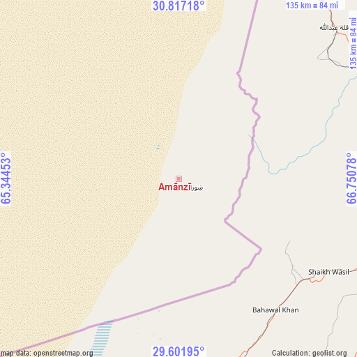
Amānzī GPS coordinates[2]
30° 12' 41.184" North, 66° 2' 51.54" East
| Map corner | latitude | longitude |
|---|---|---|
| Upper-left | 30.81718°, | 65.34453° |
| Center: | 30.21144°, | 66.04765° |
| Lower-right: | 29.60195°, | 66.75078° |
| Map W x H: | 135.1×135.1 km | = 83.9×83.9mi |
| max Lat: | 38.4435° ⇑99.7% North |
| Amānzī: | 30.21144° |
| min Lat: | ⇓0.3% South 30.15° |
| min Long | Amānzī | max Long |
| 61.06667° | 66.04765° | 72.318° |
| W 28.6%⇐ | ⇒71.4% E |
Elevation
Elevation of Amānzī is 993 m = 3258 ft, and this is 425.4 m = 1396 ft below average elevation for this country.
| Max E: |
3068 m = 10066 ft | 65.9% |
| Avg. | 1418.4 m = 4654 ft | |
| Amānzī | 993 m = 3258 ft | |
Min E: |
254 m = 833 ft | 34.1% |
See also: Afghanistan elevation on elevation.city.
Geographical zone
Amānzī is located in North temperate zone (between Tropic of Cancer and the Arctic Circle). Distance of this Northern Tropic circle is 753.3 km =468.1 mi to South.| Distance of | km | miles | from Amānzī |
|---|---|---|---|
| North Pole | 6647.9 | 4130.8 | to North |
| Arctic Circle | 4042 | 2511.6 | to North |
| Tropic Cancer | 753.3 | 468.1 | to South |
| Equator | 3359.2 | 2087.3 | to South |


Nearby cities:
15 places around Amānzī: (largest is in red/bold)
• Arghestān
155.7 km =96.7 mi,  15°
15°
• Babasakhib
165.4 km =102.8 mi,  347°
347°
• Chinār
219.7 km =136.5 mi,  335°
335°
• Kandahār
159.2 km =98.9 mi, 348°
• Khān Neshīn
219.9 km =136.6 mi,  279°
279°
• Khūgyāṉī
158.6 km =98.5 mi, 18°
• Kishk-e Nakhūd
183.5 km =114 mi,  328°
328°
• Lashkar Gāh
221.8 km =137.8 mi,  313°
313°
• Markaz-e Ḩukūmat-e Darwēshān
204.8 km =127.3 mi,  300°
300°
• Mīzān ‘Alāqahdārī
222.9 km =138.5 mi,  11°
11°
• Pāshmūl
160.7 km =99.9 mi, 338°
• Shahr-e Şafā
179 km =111.2 mi, 8°
• Spīn Bōldak
94.5 km =58.7 mi, 20°
• Zīārat-e Shāh Maqşūd
204.6 km =127.1 mi, 344°
• ‘Alāqahdārī Aṯghar
210.4 km =130.7 mi,  36°
36°
Sources, notices
• [Note1] Compared only with cities in Afghanistan existing in our database
• [Src1] Map data: © OpenStreetMap contributors (CC-BY-SA)
• [Src2] Other city data from geonames.org with taken over terms of usage.
• [Src3] Geographical zone / Annual Mean Temperature by Robert A. Rohde @ Wikipedia
