Sumbe geodata
Sumbe (Kwanza Sul) is a seat of a first-order administrative division; located in Angola in Africa/Luanda (GMT+1) time zone. With population of 33,277 people, there are 13 cities with bigger population in this country. Compared to other cities in Angola, 58.3% of cities are located further ↓South; 72.2% of cities are located further →East and 94.4% of cities have higher elevation than Sumbe. Note1


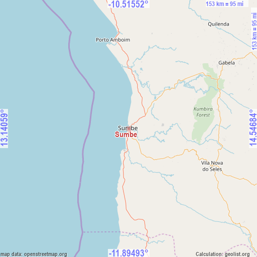
Sumbe GPS coordinates[2]
11° 12' 21.78" South, 13° 50' 37.356" East
| Map corner | latitude | longitude |
|---|---|---|
| Upper-left | -10.51552°, | 13.14059° |
| Center: | -11.20605°, | 13.84371° |
| Lower-right: | -11.89493°, | 14.54684° |
| Map W x H: | 153.4×153.4 km | = 95.3×95.3mi |
| max Lat: | -5.55° ⇑41.7% North |
| Sumbe: | -11.20605° |
| min Lat: | ⇓58.3% South -17.06667° |
| min Long | Sumbe | max Long |
| 12.15222° | 13.84371° | 22.22466° |
| W 27.8%⇐ | ⇒72.2% E |
Elevation
Elevation of Sumbe is 10 m = 33 ft, and this is 958.9 m = 3146 ft below average elevation for this country.
| Max E: |
1895 m = 6217 ft | 94.4% |
| Avg. | 968.9 m = 3179 ft | |
| Sumbe | 10 m = 33 ft | |
Min E: |
1 m = 3 ft | 5.6% |
See also: Angola elevation on elevation.city.
Geographical zone
Sumbe is located in South Torrid zone (between Equator and Tropic of Capricorn). Distance of Equator is 1246 km =774.2 mi to North.| Distance of | km | miles | from Sumbe |
|---|---|---|---|
| Equator | 1246 | 774.2 | to North |
| Tropic Capricorn | 1359.9 | 845 | to South |
| Antarctic Circle | 6155.2 | 3824.7 | to South |
| South Pole | 8761.1 | 5443.9 | to South |


Nearby cities:
15 places around Sumbe: (largest is in red/bold)
• Benguela
159.6 km =99.2 mi,  197°
197°
• Caconda
310.8 km =193.1 mi,  154°
154°
• Catumbela
139.9 km =86.9 mi,  193°
193°
• Caxito
292.8 km =181.9 mi,  356°
356°
• Caála
261.5 km =162.5 mi,  134°
134°
• Chela
211.7 km =131.5 mi, 125°
• Chinjenje
229 km =142.3 mi, 146°
• Huambo
270.1 km =167.8 mi, 130°
• Lobito
133.1 km =82.7 mi, 194°
• Longonjo
243.4 km =151.2 mi,  140°
140°
• Luanda
271.8 km =168.9 mi,  345°
345°
• Malanje
330 km =205.1 mi,  55°
55°
• N’dalatando
242.2 km =150.5 mi,  28°
28°
• Quibala
134.7 km =83.7 mi,  67°
67°
• Uacu Cungo
139.9 km =86.9 mi,  96°
96°
Sources, notices
• [Note1] Compared only with cities in Angola existing in our database
• [Src1] Map data: © OpenStreetMap contributors (CC-BY-SA)
• [Src2] Other city data from geonames.org with taken over terms of usage.
• [Src3] Geographical zone / Annual Mean Temperature by Robert A. Rohde @ Wikipedia
