Uacu Cungo geodata
Uacu Cungo (Kwanza Sul) is a populated place; located in Angola in Africa/Luanda (GMT+1) time zone. With population of 10,970 people, there are 27 cities with bigger population in this country. Compared to other cities in Angola, 55.6% of cities are located further ↓South; 52.8% of cities are located further →East and 63.9% of cities have lower elevation than Uacu Cungo. Note1


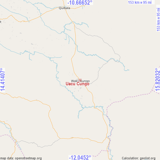
Uacu Cungo GPS coordinates[2]
11° 21' 24.084" South, 15° 7' 1.884" East
| Map corner | latitude | longitude |
|---|---|---|
| Upper-left | -10.66652°, | 14.41407° |
| Center: | -11.35669°, | 15.11719° |
| Lower-right: | -12.0452°, | 15.82032° |
| Map W x H: | 153.3×153.3 km | = 95.3×95.3mi |
| max Lat: | -5.55° ⇑44.4% North |
| Uacu Cungo: | -11.35669° |
| min Lat: | ⇓55.6% South -17.06667° |
| min Long | Uacu Cungo | max Long |
| 12.15222° | 15.11719° | 22.22466° |
| W 47.2%⇐ | ⇒52.8% E |
Elevation
Elevation of Uacu Cungo is 1304 m = 4278 ft, and this is 335.1 m = 1099 ft above average elevation for this country.
| Max E: |
1895 m = 6217 ft | 36.1% |
| Uacu Cungo | 1304 m 4278 ft | |
| Avg. | 968.9 m = 3179 ft | |
Min E: |
1 m = 3 ft | 63.9% |
See also: Angola elevation on elevation.city.
Geographical zone
Uacu Cungo is located in South Torrid zone (between Equator and Tropic of Capricorn). Distance of Equator is 1262.7 km =784.6 mi to North.| Distance of | km | miles | from Uacu Cungo |
|---|---|---|---|
| Equator | 1262.7 | 784.6 | to North |
| Tropic Capricorn | 1343.2 | 834.6 | to South |
| Antarctic Circle | 6138.4 | 3814.2 | to South |
| South Pole | 8744.3 | 5433.5 | to South |


Nearby cities:
15 places around Uacu Cungo: (largest is in red/bold)
• Benguela
230.3 km =143.1 mi,  233°
233°
• Catabola
251.8 km =156.5 mi,  110°
110°
• Catumbela
208.4 km =129.5 mi,  235°
235°
• Caála
173.2 km =107.6 mi,  163°
163°
• Chela
110.7 km =68.8 mi, 161°
• Chinjenje
175.7 km =109.2 mi,  184°
184°
• Chissamba
257.5 km =160 mi, 110°
• Cuito
228.2 km =141.8 mi,  120°
120°
• Huambo
171.7 km =106.7 mi, 156°
• Lobito
205.3 km =127.6 mi, 236°
• Longonjo
173 km =107.5 mi, 175°
• Malanje
242.3 km =150.6 mi,  33°
33°
• N’dalatando
230 km =142.9 mi,  354°
354°
• Quibala
70.9 km =44.1 mi, 347°
• Sumbe
139.9 km =86.9 mi,  276°
276°
Sources, notices
• [Note1] Compared only with cities in Angola existing in our database
• [Src1] Map data: © OpenStreetMap contributors (CC-BY-SA)
• [Src2] Other city data from geonames.org with taken over terms of usage.
• [Src3] Geographical zone / Annual Mean Temperature by Robert A. Rohde @ Wikipedia
