Catumbela geodata
Catumbela (Benguela) is a populated place; located in Angola in Africa/Luanda (GMT+1) time zone. With population of 16,977 people, there are 25 cities with bigger population in this country. Compared to other cities in Angola, 72.2% of cities are located further ↑North; 77.8% of cities are located further →East and 86.1% of cities have higher elevation than Catumbela. Note1


Catumbela GPS coordinates[2]
12° 25' 48.072" South, 13° 32' 48.372" East
| Map corner | latitude | longitude |
|---|---|---|
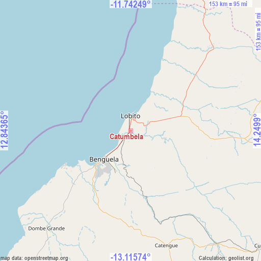
| Upper-left | -11.74249°, | 12.84365° |
| Center: | -12.43002°, | 13.54677° |
| Lower-right: | -13.11574°, | 14.2499° |
| Map W x H: | 152.7×152.7 km | = 94.9×94.9mi |
| max Lat: | -5.55° ⇑72.2% North |
| Catumbela: | -12.43002° |
| min Lat: | ⇓27.8% South -17.06667° |
| min Long | Catumbela | max Long |
| 12.15222° | 13.54677° | 22.22466° |
| W 22.2%⇐ | ⇒77.8% E |
Elevation
Elevation of Catumbela is 12 m = 39 ft, and this is 956.9 m = 3139 ft below average elevation for this country.
| Max E: |
1895 m = 6217 ft | 86.1% |
| Avg. | 968.9 m = 3179 ft | |
| Catumbela | 12 m = 39 ft | |
Min E: |
1 m = 3 ft | 13.9% |
See also: Angola elevation on elevation.city.
Geographical zone
Catumbela is located in South Torrid zone (between Equator and Tropic of Capricorn). Distance of this Southern Tropic circle is 1223.8 km =760.4 mi to South.| Distance of | km | miles | from Catumbela |
|---|---|---|---|
| Equator | 1382.1 | 858.8 | to North |
| Tropic Capricorn | 1223.8 | 760.4 | to South |
| Antarctic Circle | 6019.1 | 3740.1 | to South |
| South Pole | 8625 | 5359.3 | to South |


Nearby cities:
15 places around Catumbela: (largest is in red/bold)
• Benguela
22.4 km =13.9 mi,  223°
223°
• Caconda
219.3 km =136.3 mi,  131°
131°
• Caála
223.5 km =138.9 mi,  102°
102°
• Chela
205.4 km =127.6 mi,  86°
86°
• Chinjenje
166.5 km =103.5 mi,  109°
109°
• Cuito
367.8 km =228.5 mi, 89°
• Huambo
241 km =149.8 mi, 99°
• Lobito
7.4 km =4.6 mi,  350°
350°
• Longonjo
192.6 km =119.7 mi, 105°
• Lubango
276.6 km =171.9 mi,  181°
181°
• Namibe
342.4 km =212.8 mi,  206°
206°
• N’dalatando
378.8 km =235.4 mi,  23°
23°
• Quibala
244.8 km =152.1 mi,  39°
39°
• Sumbe
139.9 km =86.9 mi,  13°
13°
• Uacu Cungo
208.4 km =129.5 mi,  55°
55°
Sources, notices
• [Note1] Compared only with cities in Angola existing in our database
• [Src1] Map data: © OpenStreetMap contributors (CC-BY-SA)
• [Src2] Other city data from geonames.org with taken over terms of usage.
• [Src3] Geographical zone / Annual Mean Temperature by Robert A. Rohde @ Wikipedia
