Werda geodata
Werda (Kgalagadi) is a populated place; located in Botswana in Africa/Gaborone (GMT+2) time zone. With population of 2,149 people, there are 51 cities with bigger population in this country. Compared to other cities in Botswana, 94.3% of cities are located further ↑North; 83.8% of cities are located further →East and 60% of cities have lower elevation than Werda. Note1


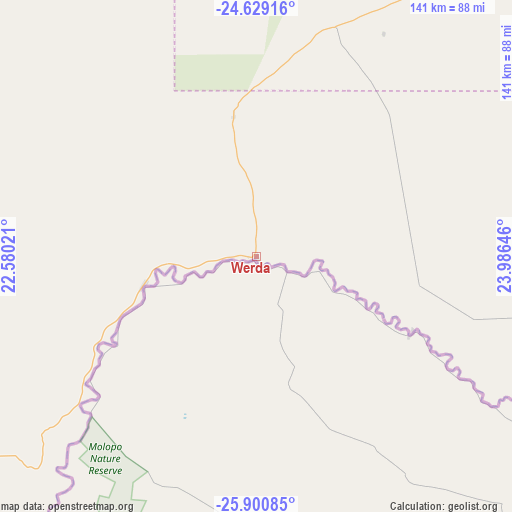
Werda GPS coordinates[2]
25° 16' 0.012" South, 23° 16' 59.988" East
| Map corner | latitude | longitude |
|---|---|---|
| Upper-left | -24.62916°, | 22.58021° |
| Center: | -25.26667°, | 23.28333° |
| Lower-right: | -25.90085°, | 23.98646° |
| Map W x H: | 141.4×141.4 km | = 87.9×87.9mi |
| max Lat: | -17.80165° ⇑94.3% North |
| Werda: | -25.26667° |
| min Lat: | ⇓5.7% South -26.9° |
| min Long | Werda | max Long |
| 20.06667° | 23.28333° | 28.74946° |
| W 16.2%⇐ | ⇒83.8% E |
Elevation
Elevation of Werda is 1034 m = 3392 ft, and this is 19 m = 62 ft above average elevation for this country.
| Max E: |
1406 m = 4613 ft | 40% |
| Werda | 1034 m 3392 ft | |
| Avg. | 1015 m = 3330 ft | |
Min E: |
676 m = 2218 ft | 60% |
See also: Botswana elevation on elevation.city.
Geographical zone
Werda is located in South temperate zone (between Tropic of Capricorn and the Antarctic Circle). Distance of this Southern Tropic circle is 203.5 km =126.4 mi to North.| Distance of | km | miles | from Werda |
|---|---|---|---|
| Equator | 2809.4 | 1745.7 | to North |
| Tropic Capricorn | 203.5 | 126.4 | to North |
| Antarctic Circle | 4591.8 | 2853.2 | to South |
| South Pole | 7197.7 | 4472.4 | to South |


Nearby cities:
15 places around Werda: (largest is in red/bold)
• Dutlwe
155.7 km =96.7 mi,  23°
23°
• Hukuntsi
207.3 km =128.8 mi,  312°
312°
• Jwaneng
163.4 km =101.5 mi,  63°
63°
• Kang
183.9 km =114.3 mi,  344°
344°
• Kanye
209 km =129.9 mi,  80°
80°
• Khakhea
67.6 km =42 mi, 18°
• Khudumelapye
213.7 km =132.8 mi,  43°
43°
• Khuis
212.7 km =132.2 mi,  222°
222°
• Lehututu
203.5 km =126.4 mi,  315°
315°
• Letlhakeng
219.4 km =136.3 mi,  53°
53°
• Lokwabe
190.8 km =118.6 mi, 309°
• Mabuli
144.1 km =89.5 mi,  113°
113°
• Sekoma
113.8 km =70.7 mi,  32°
32°
• Tshabong
120.7 km =75 mi, 223°
• Tshane
195.8 km =121.7 mi, 314°
Sources, notices
• [Note1] Compared only with cities in Botswana existing in our database
• [Src1] Map data: © OpenStreetMap contributors (CC-BY-SA)
• [Src2] Other city data from geonames.org with taken over terms of usage.
• [Src3] Geographical zone / Annual Mean Temperature by Robert A. Rohde @ Wikipedia
