Khakhea geodata
Khakhea (Ngwaketsi) is a populated place; located in Botswana in Africa/Gaborone (GMT+2) time zone. With population of 2,133 people, there are 53 cities with bigger population in this country. Compared to other cities in Botswana, 87.6% of cities are located further ↑North; 81.9% of cities are located further →East and 66.7% of cities have lower elevation than Khakhea. Note1


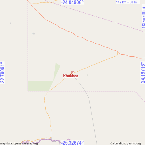
Khakhea GPS coordinates[2]
24° 41' 22.344" South, 23° 29' 38.508" East
| Map corner | latitude | longitude |
|---|---|---|
| Upper-left | -24.04906°, | 22.79091° |
| Center: | -24.68954°, | 23.49403° |
| Lower-right: | -25.32674°, | 24.19716° |
| Map W x H: | 142.1×142.1 km | = 88.3×88.3mi |
| max Lat: | -17.80165° ⇑87.6% North |
| Khakhea: | -24.68954° |
| min Lat: | ⇓12.4% South -26.9° |
| min Long | Khakhea | max Long |
| 20.06667° | 23.49403° | 28.74946° |
| W 18.1%⇐ | ⇒81.9% E |
Elevation
Elevation of Khakhea is 1055 m = 3461 ft, and this is 40 m = 131 ft above average elevation for this country.
| Max E: |
1406 m = 4613 ft | 33.3% |
| Khakhea | 1055 m 3461 ft | |
| Avg. | 1015 m = 3330 ft | |
Min E: |
676 m = 2218 ft | 66.7% |
See also: Botswana elevation on elevation.city.
Geographical zone
Khakhea is located in South temperate zone (between Tropic of Capricorn and the Antarctic Circle). Distance of this Southern Tropic circle is 139.3 km =86.6 mi to North.| Distance of | km | miles | from Khakhea |
|---|---|---|---|
| Equator | 2745.2 | 1705.8 | to North |
| Tropic Capricorn | 139.3 | 86.6 | to North |
| Antarctic Circle | 4656 | 2893.1 | to South |
| South Pole | 7261.8 | 4512.3 | to South |


Nearby cities:
15 places around Khakhea: (largest is in red/bold)
• Dutlwe
88.6 km =55.1 mi,  27°
27°
• Hukuntsi
189.9 km =118 mi,  293°
293°
• Jwaneng
125.1 km =77.7 mi,  85°
85°
• Kang
133.6 km =83 mi,  327°
327°
• Kanye
188.1 km =116.9 mi,  99°
99°
• Khudumelapye
155.7 km =96.7 mi,  54°
54°
• Lehututu
183.4 km =114 mi,  295°
295°
• Letlhakeng
169 km =105 mi,  66°
66°
• Lokwabe
177.9 km =110.5 mi, 289°
• Mabuli
164.8 km =102.4 mi,  137°
137°
• Mosopa
194.9 km =121.1 mi, 92°
• Sekoma
50.9 km =31.6 mi, 50°
• Tshabong
184.1 km =114.4 mi,  214°
214°
• Tshane
177.2 km =110.1 mi, 294°
• Werda
67.6 km =42 mi,  198°
198°
Sources, notices
• [Note1] Compared only with cities in Botswana existing in our database
• [Src1] Map data: © OpenStreetMap contributors (CC-BY-SA)
• [Src2] Other city data from geonames.org with taken over terms of usage.
• [Src3] Geographical zone / Annual Mean Temperature by Robert A. Rohde @ Wikipedia
