Tshabong geodata
Tshabong (Kgalagadi) is a seat of a first-order administrative division; located in Botswana in Africa/Gaborone (GMT+2) time zone. With population of 6,591 people, there are 24 cities with bigger population in this country. Compared to other cities in Botswana, 98.1% of cities are located further ↑North; 88.6% of cities are located further →East and 57.1% of cities have higher elevation than Tshabong. Note1


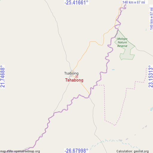
Tshabong GPS coordinates[2]
26° 3' 0" South, 22° 27' 0" East
| Map corner | latitude | longitude |
|---|---|---|
| Upper-left | -25.41661°, | 21.74688° |
| Center: | -26.05°, | 22.45° |
| Lower-right: | -26.67998°, | 23.15313° |
| Map W x H: | 140.5×140.5 km | = 87.3×87.3mi |
| max Lat: | -17.80165° ⇑98.1% North |
| Tshabong: | -26.05° |
| min Lat: | ⇓1.9% South -26.9° |
| min Long | Tshabong | max Long |
| 20.06667° | 22.45° | 28.74946° |
| W 11.4%⇐ | ⇒88.6% E |
Elevation
Elevation of Tshabong is 976 m = 3202 ft, and this is 39 m = 128 ft below average elevation for this country.
| Max E: |
1406 m = 4613 ft | 57.1% |
| Avg. | 1015 m = 3330 ft | |
| Tshabong | 976 m = 3202 ft | |
Min E: |
676 m = 2218 ft | 42.9% |
See also: Botswana elevation on elevation.city.
Geographical zone
Tshabong is located in South temperate zone (between Tropic of Capricorn and the Antarctic Circle). Distance of this Southern Tropic circle is 290.6 km =180.6 mi to North.| Distance of | km | miles | from Tshabong |
|---|---|---|---|
| Equator | 2896.5 | 1799.8 | to North |
| Tropic Capricorn | 290.6 | 180.6 | to North |
| Antarctic Circle | 4504.7 | 2799.1 | to South |
| South Pole | 7110.6 | 4418.3 | to South |


Nearby cities:
15 places around Tshabong: (largest is in red/bold)
• Bokspits
198.2 km =123.2 mi,  241°
241°
• Dutlwe
272.3 km =169.2 mi,  32°
32°
• Hukuntsi
237.9 km =147.8 mi,  343°
343°
• Jwaneng
279.9 km =173.9 mi,  54°
54°
• Kang
266.2 km =165.4 mi,  7°
7°
• Kanye
313.3 km =194.7 mi,  67°
67°
• Khakhea
184.1 km =114.4 mi, 34°
• Khuis
92.1 km =57.2 mi,  221°
221°
• Lehututu
239 km =148.5 mi,  345°
345°
• Lokwabe
218.4 km =135.7 mi, 343°
• Mabuli
217 km =134.8 mi,  82°
82°
• Manyana
303.8 km =188.8 mi, 345°
• Sekoma
233.3 km =145 mi,  38°
38°
• Tshane
231 km =143.5 mi, 346°
• Werda
120.7 km =75 mi, 43°
Sources, notices
• [Note1] Compared only with cities in Botswana existing in our database
• [Src1] Map data: © OpenStreetMap contributors (CC-BY-SA)
• [Src2] Other city data from geonames.org with taken over terms of usage.
• [Src3] Geographical zone / Annual Mean Temperature by Robert A. Rohde @ Wikipedia
