Khuis geodata
Khuis is a populated place; located in Botswana in Africa/Gaborone (GMT+2) time zone. With population of 827 people, there are 92 cities with bigger population in this country. Compared to other cities in Botswana, 99% of cities are located further ↑North; 95.2% of cities are located further →East and 85.7% of cities have higher elevation than Khuis. Note1


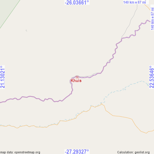
Khuis GPS coordinates[2]
26° 40' 0.012" South, 21° 49' 59.988" East
| Map corner | latitude | longitude |
|---|---|---|
| Upper-left | -26.03661°, | 21.13021° |
| Center: | -26.66667°, | 21.83333° |
| Lower-right: | -27.29327°, | 22.53646° |
| Map W x H: | 139.7×139.7 km | = 86.8×86.8mi |
| max Lat: | -17.80165° ⇑99% North |
| Khuis: | -26.66667° |
| min Lat: | ⇓1% South -26.9° |
| min Long | Khuis | max Long |
| 20.06667° | 21.83333° | 28.74946° |
| W 4.8%⇐ | ⇒95.2% E |
Elevation
Elevation of Khuis is 899 m = 2949 ft, and this is 116 m = 381 ft below average elevation for this country.
| Max E: |
1406 m = 4613 ft | 85.7% |
| Avg. | 1015 m = 3330 ft | |
| Khuis | 899 m = 2949 ft | |
Min E: |
676 m = 2218 ft | 14.3% |
See also: Botswana elevation on elevation.city.
Geographical zone
Khuis is located in South temperate zone (between Tropic of Capricorn and the Antarctic Circle). Distance of this Southern Tropic circle is 359.1 km =223.1 mi to North.| Distance of | km | miles | from Khuis |
|---|---|---|---|
| Equator | 2965.1 | 1842.4 | to North |
| Tropic Capricorn | 359.1 | 223.1 | to North |
| Antarctic Circle | 4436.1 | 2756.5 | to South |
| South Pole | 7042 | 4375.7 | to South |


Nearby cities:
15 places around Khuis: (largest is in red/bold)
• Bokspits
115.4 km =71.7 mi,  257°
257°
• Dutlwe
363.5 km =225.9 mi,  34°
34°
• Hukuntsi
296.7 km =184.4 mi,  358°
358°
• Janeng
396.4 km =246.3 mi,  69°
69°
• Jwaneng
370 km =229.9 mi,  51°
51°
• Kang
346.2 km =215.1 mi,  16°
16°
• Khakhea
275.7 km =171.3 mi,  37°
37°
• Lehututu
300.2 km =186.5 mi,  0°
0°
• Lokwabe
278 km =172.7 mi, 0°
• Mabuli
292.9 km =182 mi, 70°
• Manyana
363.4 km =225.8 mi, 358°
• Sekoma
325.3 km =202.1 mi, 39°
• Tshabong
92.1 km =57.2 mi, 41°
• Tshane
292.9 km =182 mi, 1°
• Werda
212.7 km =132.2 mi, 42°
Sources, notices
• [Note1] Compared only with cities in Botswana existing in our database
• [Src1] Map data: © OpenStreetMap contributors (CC-BY-SA)
• [Src2] Other city data from geonames.org with taken over terms of usage.
• [Src3] Geographical zone / Annual Mean Temperature by Robert A. Rohde @ Wikipedia
