Lehututu geodata
Lehututu (Kgalagadi) is a populated place; located in Botswana in Africa/Gaborone (GMT+2) time zone. With population of 1,942 people, there are 57 cities with bigger population in this country. Compared to other cities in Botswana, 61% of cities are located further ↑North; 92.4% of cities are located further →East and 81% of cities have lower elevation than Lehututu. Note1


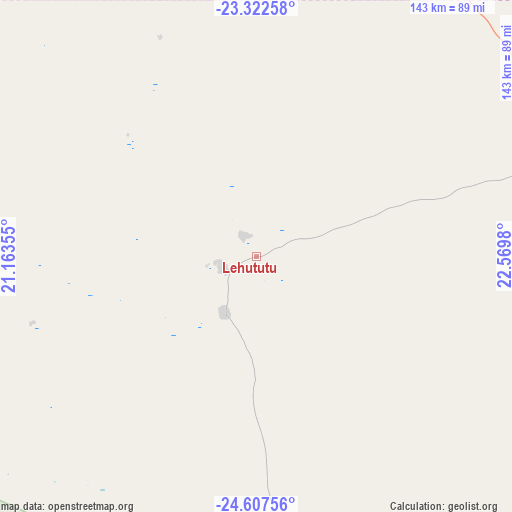
Lehututu GPS coordinates[2]
23° 58' 0.012" South, 21° 52' 0.012" East
| Map corner | latitude | longitude |
|---|---|---|
| Upper-left | -23.32258°, | 21.16355° |
| Center: | -23.96667°, | 21.86667° |
| Lower-right: | -24.60756°, | 22.5698° |
| Map W x H: | 142.9×142.9 km | = 88.8×88.8mi |
| max Lat: | -17.80165° ⇑61% North |
| Lehututu: | -23.96667° |
| min Lat: | ⇓39% South -26.9° |
| min Long | Lehututu | max Long |
| 20.06667° | 21.86667° | 28.74946° |
| W 7.6%⇐ | ⇒92.4% E |
Elevation
Elevation of Lehututu is 1133 m = 3717 ft, and this is 118 m = 387 ft above average elevation for this country.
| Max E: |
1406 m = 4613 ft | 19% |
| Lehututu | 1133 m 3717 ft | |
| Avg. | 1015 m = 3330 ft | |
Min E: |
676 m = 2218 ft | 81% |
See also: Botswana elevation on elevation.city.
Geographical zone
Lehututu is located in South temperate zone (between Tropic of Capricorn and the Antarctic Circle). Distance of this Southern Tropic circle is 58.9 km =36.6 mi to North.| Distance of | km | miles | from Lehututu |
|---|---|---|---|
| Equator | 2664.8 | 1655.8 | to North |
| Tropic Capricorn | 58.9 | 36.6 | to North |
| Antarctic Circle | 4736.3 | 2943 | to South |
| South Pole | 7342.2 | 4562.2 | to South |


Nearby cities:
15 places around Lehututu: (largest is in red/bold)
• Dekar
270.6 km =168.1 mi,  1°
1°
• Dutlwe
206.6 km =128.4 mi,  90°
90°
• Ghanzi
253.3 km =157.4 mi,  354°
354°
• Hukuntsi
9.5 km =5.9 mi,  248°
248°
• Jwaneng
298.5 km =185.5 mi,  103°
103°
• Kang
99.1 km =61.6 mi,  70°
70°
• Khakhea
183.4 km =114 mi,  115°
115°
• Khudumelapye
293.2 km =182.2 mi, 88°
• Kuli
209.9 km =130.4 mi,  299°
299°
• Lokwabe
22.5 km =14 mi,  188°
188°
• Manyana
64.8 km =40.3 mi, 346°
• Sekoma
210.1 km =130.6 mi, 103°
• Tshabong
239 km =148.5 mi,  165°
165°
• Tshane
8.1 km =5 mi,  155°
155°
• Werda
203.5 km =126.4 mi,  135°
135°
Sources, notices
• [Note1] Compared only with cities in Botswana existing in our database
• [Src1] Map data: © OpenStreetMap contributors (CC-BY-SA)
• [Src2] Other city data from geonames.org with taken over terms of usage.
• [Src3] Geographical zone / Annual Mean Temperature by Robert A. Rohde @ Wikipedia
