Lokwabe geodata
Lokwabe is a populated place; located in Botswana in Africa/Gaborone (GMT+2) time zone. With population of 1,473 people, there are 71 cities with bigger population in this country. Compared to other cities in Botswana, 66.7% of cities are located further ↑North; 95.2% of cities are located further →East and 80% of cities have lower elevation than Lokwabe. Note1


Lokwabe GPS coordinates[2]
24° 10' 0.012" South, 21° 49' 59.988" East
| Map corner | latitude | longitude |
|---|---|---|
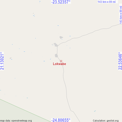
| Upper-left | -23.52357°, | 21.13021° |
| Center: | -24.16667°, | 21.83333° |
| Lower-right: | -24.80655°, | 22.53646° |
| Map W x H: | 142.7×142.7 km | = 88.7×88.7mi |
| max Lat: | -17.80165° ⇑66.7% North |
| Lokwabe: | -24.16667° |
| min Lat: | ⇓33.3% South -26.9° |
| min Long | Lokwabe | max Long |
| 20.06667° | 21.83333° | 28.74946° |
| W 4.8%⇐ | ⇒95.2% E |
Elevation
Elevation of Lokwabe is 1120 m = 3675 ft, and this is 105 m = 344 ft above average elevation for this country.
| Max E: |
1406 m = 4613 ft | 20% |
| Lokwabe | 1120 m 3675 ft | |
| Avg. | 1015 m = 3330 ft | |
Min E: |
676 m = 2218 ft | 80% |
See also: Botswana elevation on elevation.city.
Geographical zone
Lokwabe is located in South temperate zone (between Tropic of Capricorn and the Antarctic Circle). Distance of this Southern Tropic circle is 81.2 km =50.5 mi to North.| Distance of | km | miles | from Lokwabe |
|---|---|---|---|
| Equator | 2687.1 | 1669.7 | to North |
| Tropic Capricorn | 81.2 | 50.5 | to North |
| Antarctic Circle | 4714.1 | 2929.2 | to South |
| South Pole | 7320 | 4548.4 | to South |


Nearby cities:
15 places around Lokwabe: (largest is in red/bold)
• Dekar
293 km =182.1 mi,  2°
2°
• Dutlwe
210.8 km =131 mi,  84°
84°
• Ghanzi
275.2 km =171 mi,  355°
355°
• Hukuntsi
19.4 km =12.1 mi,  343°
343°
• Jwaneng
297.1 km =184.6 mi,  99°
99°
• Kang
111.3 km =69.2 mi,  60°
60°
• Khakhea
177.9 km =110.5 mi,  109°
109°
• Khuis
278 km =172.7 mi,  180°
180°
• Kuli
218.7 km =135.9 mi,  304°
304°
• Lehututu
22.5 km =14 mi,  8°
8°
• Manyana
86.1 km =53.5 mi,  352°
352°
• Sekoma
209.4 km =130.1 mi, 97°
• Tshabong
218.4 km =135.7 mi,  163°
163°
• Tshane
16.3 km =10.1 mi,  24°
24°
• Werda
190.8 km =118.6 mi,  129°
129°
Sources, notices
• [Note1] Compared only with cities in Botswana existing in our database
• [Src1] Map data: © OpenStreetMap contributors (CC-BY-SA)
• [Src2] Other city data from geonames.org with taken over terms of usage.
• [Src3] Geographical zone / Annual Mean Temperature by Robert A. Rohde @ Wikipedia
