Letlhakane geodata
Letlhakane (Central) is a populated place; located in Botswana in Africa/Gaborone (GMT+2) time zone. With population of 18,136 people, there are 15 cities with bigger population in this country. Compared to other cities in Botswana, 77.1% of cities are located further ↓South; 62.9% of cities are located further →East and 54.3% of cities have higher elevation than Letlhakane. Note1


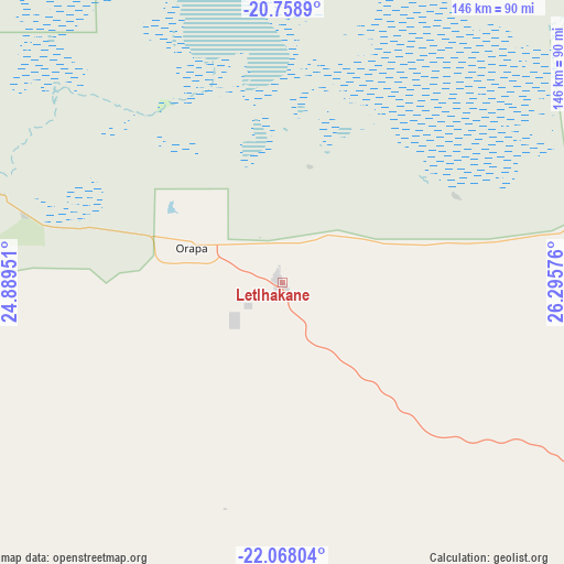
Letlhakane GPS coordinates[2]
21° 24' 53.784" South, 25° 35' 33.468" East
| Map corner | latitude | longitude |
|---|---|---|
| Upper-left | -20.7589°, | 24.88951° |
| Center: | -21.41494°, | 25.59263° |
| Lower-right: | -22.06804°, | 26.29576° |
| Map W x H: | 145.6×145.6 km | = 90.5×90.5mi |
| max Lat: | -17.80165° ⇑22.9% North |
| Letlhakane: | -21.41494° |
| min Lat: | ⇓77.1% South -26.9° |
| min Long | Letlhakane | max Long |
| 20.06667° | 25.59263° | 28.74946° |
| W 37.1%⇐ | ⇒62.9% E |
Elevation
Elevation of Letlhakane is 984 m = 3228 ft, and this is 31 m = 102 ft below average elevation for this country.
| Max E: |
1406 m = 4613 ft | 54.3% |
| Avg. | 1015 m = 3330 ft | |
| Letlhakane | 984 m = 3228 ft | |
Min E: |
676 m = 2218 ft | 45.7% |
See also: Botswana elevation on elevation.city.
Geographical zone
Letlhakane is located in South Torrid zone (between Equator and Tropic of Capricorn). Distance of this Southern Tropic circle is 224.8 km =139.7 mi to South.| Distance of | km | miles | from Letlhakane |
|---|---|---|---|
| Equator | 2381.1 | 1479.5 | to North |
| Tropic Capricorn | 224.8 | 139.7 | to South |
| Antarctic Circle | 5020.1 | 3119.3 | to South |
| South Pole | 7625.9 | 4738.5 | to South |


Nearby cities:
15 places around Letlhakane: (largest is in red/bold)
• Dukwe
126 km =78.3 mi,  42°
42°
• Gweta
141.9 km =88.2 mi,  344°
344°
• Kalamare
196.6 km =122.2 mi,  149°
149°
• Makaleng
184.4 km =114.6 mi,  71°
71°
• Mathambgwane
186.3 km =115.8 mi,  75°
75°
• Moijabana
141.6 km =88 mi,  143°
143°
• Mopipi
77.9 km =48.4 mi,  289°
289°
• Mosetse
132.3 km =82.2 mi,  56°
56°
• Nata
146.7 km =91.2 mi,  24°
24°
• Orapa
25.2 km =15.7 mi,  297°
297°
• Rakops
135 km =83.9 mi, 288°
• Sebina
182.4 km =113.3 mi, 70°
• Serowe
158.1 km =98.2 mi,  133°
133°
• Sua
164.4 km =102.2 mi, 22°
• Tonota
193.5 km =120.2 mi,  90°
90°
Sources, notices
• [Note1] Compared only with cities in Botswana existing in our database
• [Src1] Map data: © OpenStreetMap contributors (CC-BY-SA)
• [Src2] Other city data from geonames.org with taken over terms of usage.
• [Src3] Geographical zone / Annual Mean Temperature by Robert A. Rohde @ Wikipedia
