Masunga geodata
Masunga (North-East) is a seat of a second-order administrative division; located in Botswana in Africa/Gaborone (GMT+2) time zone. With population of 3,639 people, there are 39 cities with bigger population in this country. Compared to other cities in Botswana, 85.7% of cities are located further ↓South; 86.7% of cities are located further ←West and 94.3% of cities have lower elevation than Masunga. Note1


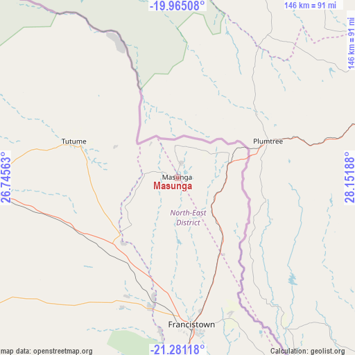
Masunga GPS coordinates[2]
20° 37' 28.38" South, 27° 26' 55.5" East
| Map corner | latitude | longitude |
|---|---|---|
| Upper-left | -19.96508°, | 26.74563° |
| Center: | -20.62455°, | 27.44875° |
| Lower-right: | -21.28118°, | 28.15188° |
| Map W x H: | 146.3×146.3 km | = 90.9×90.9mi |
| max Lat: | -17.80165° ⇑14.3% North |
| Masunga: | -20.62455° |
| min Lat: | ⇓85.7% South -26.9° |
| min Long | Masunga | max Long |
| 20.06667° | 27.44875° | 28.74946° |
| W 86.7%⇐ | ⇒13.3% E |
Elevation
Elevation of Masunga is 1199 m = 3934 ft, and this is 184 m = 604 ft above average elevation for this country.
| Max E: |
1406 m = 4613 ft | 5.7% |
| Masunga | 1199 m 3934 ft | |
| Avg. | 1015 m = 3330 ft | |
Min E: |
676 m = 2218 ft | 94.3% |
See also: Botswana elevation on elevation.city.
Geographical zone
Masunga is located in South Torrid zone (between Equator and Tropic of Capricorn). Distance of this Southern Tropic circle is 312.7 km =194.3 mi to South.| Distance of | km | miles | from Masunga |
|---|---|---|---|
| Equator | 2293.2 | 1424.9 | to North |
| Tropic Capricorn | 312.7 | 194.3 | to South |
| Antarctic Circle | 5107.9 | 3173.9 | to South |
| South Pole | 7713.8 | 4793.1 | to South |


Nearby cities:
15 places around Masunga: (largest is in red/bold)
• Dukwe
107.5 km =66.8 mi,  272°
272°
• Francistown
61 km =37.9 mi,  174°
174°
• Gobojango
188.8 km =117.3 mi,  135°
135°
• Kalakamati
14.8 km =9.2 mi,  283°
283°
• Makaleng
35.1 km =21.8 mi,  209°
209°
• Mathambgwane
42.5 km =26.4 mi,  196°
196°
• Mogapi
193 km =119.9 mi, 168°
• Mosetse
84.2 km =52.3 mi,  260°
260°
• Nata
139.4 km =86.6 mi,  288°
288°
• Sebina
33.9 km =21.1 mi,  217°
217°
• Sefophe
181.4 km =112.7 mi,  162°
162°
• Selebi-Phikwe
156 km =96.9 mi, 164°
• Sua
145 km =90.1 mi,  296°
296°
• Tobane
154.6 km =96.1 mi, 162°
• Tonota
90.9 km =56.5 mi,  179°
179°
Sources, notices
• [Note1] Compared only with cities in Botswana existing in our database
• [Src1] Map data: © OpenStreetMap contributors (CC-BY-SA)
• [Src2] Other city data from geonames.org with taken over terms of usage.
• [Src3] Geographical zone / Annual Mean Temperature by Robert A. Rohde @ Wikipedia
