Makaleng geodata
Makaleng (North-East) is a populated place; located in Botswana in Africa/Gaborone (GMT+2) time zone. With population of 1,166 people, there are 78 cities with bigger population in this country. Compared to other cities in Botswana, 82.9% of cities are located further ↓South; 78.1% of cities are located further ←West and 67.6% of cities have lower elevation than Makaleng. Note1


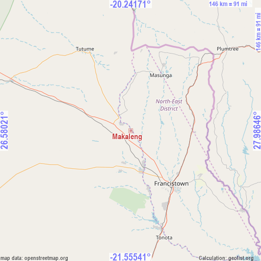
Makaleng GPS coordinates[2]
20° 54' 0" South, 27° 16' 59.988" East
| Map corner | latitude | longitude |
|---|---|---|
| Upper-left | -20.24171°, | 26.58021° |
| Center: | -20.9°, | 27.28333° |
| Lower-right: | -21.55541°, | 27.98646° |
| Map W x H: | 146.1×146.1 km | = 90.8×90.8mi |
| max Lat: | -17.80165° ⇑17.1% North |
| Makaleng: | -20.9° |
| min Lat: | ⇓82.9% South -26.9° |
| min Long | Makaleng | max Long |
| 20.06667° | 27.28333° | 28.74946° |
| W 78.1%⇐ | ⇒21.9% E |
Elevation
Elevation of Makaleng is 1064 m = 3491 ft, and this is 49 m = 161 ft above average elevation for this country.
| Max E: |
1406 m = 4613 ft | 32.4% |
| Makaleng | 1064 m 3491 ft | |
| Avg. | 1015 m = 3330 ft | |
Min E: |
676 m = 2218 ft | 67.6% |
See also: Botswana elevation on elevation.city.
Geographical zone
Makaleng is located in South Torrid zone (between Equator and Tropic of Capricorn). Distance of this Southern Tropic circle is 282.1 km =175.3 mi to South.| Distance of | km | miles | from Makaleng |
|---|---|---|---|
| Equator | 2323.9 | 1444 | to North |
| Tropic Capricorn | 282.1 | 175.3 | to South |
| Antarctic Circle | 5077.3 | 3154.9 | to South |
| South Pole | 7683.2 | 4774.1 | to South |


Nearby cities:
15 places around Makaleng: (largest is in red/bold)
• Dukwe
96.8 km =60.1 mi,  291°
291°
• Francistown
38 km =23.6 mi,  142°
142°
• Kalakamati
34.3 km =21.3 mi,  4°
4°
• Masunga
35.1 km =21.8 mi,  29°
29°
• Mathambgwane
11.3 km =7 mi,  153°
153°
• Mogapi
168.2 km =104.5 mi,  160°
160°
• Mogapinyana
166.3 km =103.3 mi,  168°
168°
• Mosetse
67.9 km =42.2 mi,  284°
284°
• Nata
137.4 km =85.4 mi,  303°
303°
• Sebina
5.1 km =3.2 mi,  316°
316°
• Sefophe
159.2 km =98.9 mi, 153°
• Selebi-Phikwe
133.2 km =82.8 mi, 154°
• Sua
147.2 km =91.5 mi,  309°
309°
• Tobane
133.1 km =82.7 mi, 151°
• Tonota
63.1 km =39.2 mi, 162°
Sources, notices
• [Note1] Compared only with cities in Botswana existing in our database
• [Src1] Map data: © OpenStreetMap contributors (CC-BY-SA)
• [Src2] Other city data from geonames.org with taken over terms of usage.
• [Src3] Geographical zone / Annual Mean Temperature by Robert A. Rohde @ Wikipedia
