Alpujarra geodata
Alpujarra (Tolima) is a seat of a second-order administrative division; located in Colombia in America/Bogota (GMT-5) time zone. In our database, there are 1053 cities with bigger population. Compared to other cities in Colombia, 82% of cities are located further ↑North; 52.7% of cities are located further →East and 55.4% of cities have lower elevation than Alpujarra. Note1


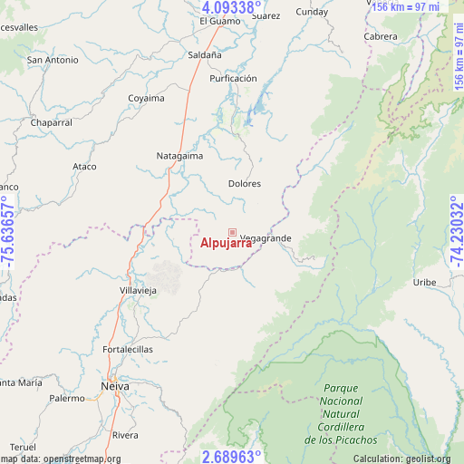
Alpujarra GPS coordinates[2]
3° 23' 30.336" North, 74° 56' 0.384" West
| Map corner | latitude | longitude |
|---|---|---|
| Upper-left | 4.09338°, | -75.63657° |
| Center: | 3.39176°, | -74.93344° |
| Lower-right: | 2.68963°, | -74.23032° |
| Map W x H: | 156.1×156.1 km | = 97×97mi |
| max Lat: | 13.38166° ⇑82% North |
| Alpujarra: | 3.39176° |
| min Lat: | ⇓18% South -4.21528° |
| min Long | Alpujarra | max Long |
| -81.70636° | -74.93344° | -67.06996° |
| W 47.3%⇐ | ⇒52.7% E |
Elevation
Elevation of Alpujarra is 1307 m = 4288 ft, and this is 157.7 m = 517 ft above average elevation for this country.
| Max E: |
3342 m = 10965 ft | 44.6% |
| Alpujarra | 1307 m 4288 ft | |
| Avg. | 1149.3 m = 3771 ft | |
Min E: |
1 m = 3 ft | 55.4% |
See also: Colombia elevation on elevation.city.
Geographical zone
Alpujarra is located in North Torrid zone (between Equator and Tropic of Cancer). Distance of Equator is 377.1 km =234.3 mi to South.| Distance of | km | miles | from Alpujarra |
|---|---|---|---|
| North Pole | 9629.9 | 5983.7 | to North |
| Arctic Circle | 7024 | 4364.5 | to North |
| Tropic Cancer | 2228.8 | 1384.9 | to North |
| Equator | 377.1 | 234.3 | to South |


Nearby cities:
15 places around Alpujarra: (largest is in red/bold)
• Aipe
38.6 km =24 mi,  240°
240°
• Ataco
54.5 km =33.9 mi,  294°
294°
• Baraya
29.7 km =18.5 mi,  206°
206°
• Colombia
14.7 km =9.1 mi,  96°
96°
• Coyaima
53.8 km =33.4 mi,  327°
327°
• Dolores
16.9 km =10.5 mi,  13°
13°
• Natagaima
31.1 km =19.3 mi,  324°
324°
• Neiva
64.5 km =40.1 mi,  216°
216°
• Prado
40 km =24.9 mi,  0°
0°
• Purificación
51.9 km =32.2 mi, 0°
• Saldaña
60.4 km =37.5 mi,  351°
351°
• Santa Isabel
7 km =4.3 mi,  228°
228°
• Tello
42.6 km =26.5 mi, 212°
• Tres Esquinas
58.2 km =36.2 mi,  25°
25°
• Villavieja
36.9 km =22.9 mi, 238°
Sources, notices
• [Note1] Compared only with cities in Colombia existing in our database
• [Src1] Map data: © OpenStreetMap contributors (CC-BY-SA)
• [Src2] Other city data from geonames.org with taken over terms of usage.
• [Src3] Geographical zone / Annual Mean Temperature by Robert A. Rohde @ Wikipedia
