Youkounkoun geodata
Youkounkoun (Boke) is a populated place; located in Guinea in Africa/Conakry (GMT+0) time zone. With population of 7,952 people, there are 28 cities with bigger population in this country. Compared to other cities in Guinea, 100% of cities are located further ↓South; 69.2% of cities are located further →East and 79.5% of cities have higher elevation than Youkounkoun. Note1


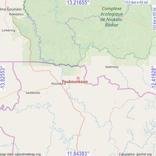
Youkounkoun GPS coordinates[2]
12° 31' 51.96" North, 13° 7' 20.64" West
| Map corner | latitude | longitude |
|---|---|---|
| Upper-left | 13.21655°, | -13.82553° |
| Center: | 12.5311°, | -13.1224° |
| Lower-right: | 11.84383°, | -12.41928° |
| Map W x H: | 152.6×152.6 km | = 94.8×94.8mi |
| max Lat: | 12.5311° ⇑0% North |
| Youkounkoun: | 12.5311° |
| min Lat: | ⇓100% South 7.56748° |
| min Long | Youkounkoun | max Long |
| -14.36667° | -13.1224° | -8.53333° |
| W 30.8%⇐ | ⇒69.2% E |
Elevation
Elevation of Youkounkoun is 76 m = 249 ft, and this is 357.4 m = 1173 ft below average elevation for this country.
| Max E: |
1440 m = 4724 ft | 79.5% |
| Avg. | 433.4 m = 1422 ft | |
| Youkounkoun | 76 m = 249 ft | |
Min E: |
0 m = 0 ft | 20.5% |
See also: Guinea elevation on elevation.city.
Geographical zone
Youkounkoun is located in North Torrid zone (between Equator and Tropic of Cancer). Distance of this Northern Tropic circle is 1212.6 km =753.5 mi to North.| Distance of | km | miles | from Youkounkoun |
|---|---|---|---|
| North Pole | 8613.7 | 5352.3 | to North |
| Arctic Circle | 6007.8 | 3733.1 | to North |
| Tropic Cancer | 1212.6 | 753.5 | to North |
| Equator | 1393.3 | 865.8 | to South |


Nearby cities:
15 places around Youkounkoun: (largest is in red/bold)
• Boké
218.6 km =135.8 mi,  215°
215°
• Dalaba
225.4 km =140.1 mi,  155°
155°
• Fria
245.8 km =152.7 mi,  191°
191°
• Gaoual
87.3 km =54.2 mi, 185°
• Kimbo
241.5 km =150.1 mi, 191°
• Koubia
169.9 km =105.6 mi,  128°
128°
• Koundara
20 km =12.4 mi,  254°
254°
• Labé
162.8 km =101.2 mi,  145°
145°
• Lélouma
132.1 km =82.1 mi, 158°
• Mali
102.7 km =63.8 mi,  119°
119°
• Pita
181.8 km =113 mi, 154°
• Sanguéya
244.6 km =152 mi,  213°
213°
• Tondon
241.9 km =150.3 mi, 185°
• Tougué
199.3 km =123.8 mi, 127°
• Télimélé
181.6 km =112.8 mi,  176°
176°
Sources, notices
• [Note1] Compared only with cities in Guinea existing in our database
• [Src1] Map data: © OpenStreetMap contributors (CC-BY-SA)
• [Src2] Other city data from geonames.org with taken over terms of usage.
• [Src3] Geographical zone / Annual Mean Temperature by Robert A. Rohde @ Wikipedia
