Mali geodata
Mali (Labe) is a seat of a second-order administrative division; located in Guinea in Africa/Conakry (GMT+0) time zone. With population of 5,479 people, there are 35 cities with bigger population in this country. Compared to other cities in Guinea, 94.9% of cities are located further ↓South; 53.8% of cities are located further →East and 100% of cities have lower elevation than Mali. Note1


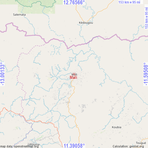
Mali GPS coordinates[2]
12° 4' 44.4" North, 12° 17' 53.52" West
| Map corner | latitude | longitude |
|---|---|---|
| Upper-left | 12.76566°, | -13.00133° |
| Center: | 12.079°, | -12.2982° |
| Lower-right: | 11.39058°, | -11.59508° |
| Map W x H: | 152.9×152.9 km | = 95×95mi |
| max Lat: | 12.5311° ⇑5.1% North |
| Mali: | 12.079° |
| min Lat: | ⇓94.9% South 7.56748° |
| min Long | Mali | max Long |
| -14.36667° | -12.2982° | -8.53333° |
| W 46.2%⇐ | ⇒53.8% E |
Elevation
Elevation of Mali is 1440 m = 4724 ft, and this is 1006.6 m = 3302 ft above average elevation for this country.
| Max E: |
1440 m = 4724 ft | 0% |
| Mali | 1440 m 4724 ft | |
| Avg. | 433.4 m = 1422 ft | |
Min E: |
0 m = 0 ft | 100% |
See also: Guinea elevation on elevation.city.
Geographical zone
Mali is located in North Torrid zone (between Equator and Tropic of Cancer). Distance of this Northern Tropic circle is 1262.9 km =784.7 mi to North.| Distance of | km | miles | from Mali |
|---|---|---|---|
| North Pole | 8664 | 5383.6 | to North |
| Arctic Circle | 6058.1 | 3764.3 | to North |
| Tropic Cancer | 1262.9 | 784.7 | to North |
| Equator | 1343.1 | 834.6 | to South |


Nearby cities:
15 places around Mali: (largest is in red/bold)
• Dabola
197.2 km =122.5 mi,  138°
138°
• Dalaba
154.3 km =95.9 mi,  178°
178°
• Dinguiraye
193.7 km =120.4 mi,  116°
116°
• Gaoual
104.7 km =65.1 mi,  249°
249°
• Kimbo
231.3 km =143.7 mi,  216°
216°
• Koubia
70.2 km =43.6 mi, 141°
• Koundara
117.8 km =73.2 mi,  292°
292°
• Labé
84.6 km =52.6 mi, 178°
• Lélouma
84 km =52.2 mi,  209°
209°
• Mamou
190.8 km =118.6 mi,  173°
173°
• Pita
113.9 km =70.8 mi,  185°
185°
• Tondon
222.3 km =138.1 mi, 211°
• Tougué
98.6 km =61.3 mi, 135°
• Télimélé
153.6 km =95.4 mi, 211°
• Youkounkoun
102.7 km =63.8 mi,  299°
299°
Sources, notices
• [Note1] Compared only with cities in Guinea existing in our database
• [Src1] Map data: © OpenStreetMap contributors (CC-BY-SA)
• [Src2] Other city data from geonames.org with taken over terms of usage.
• [Src3] Geographical zone / Annual Mean Temperature by Robert A. Rohde @ Wikipedia
